
Skip to content
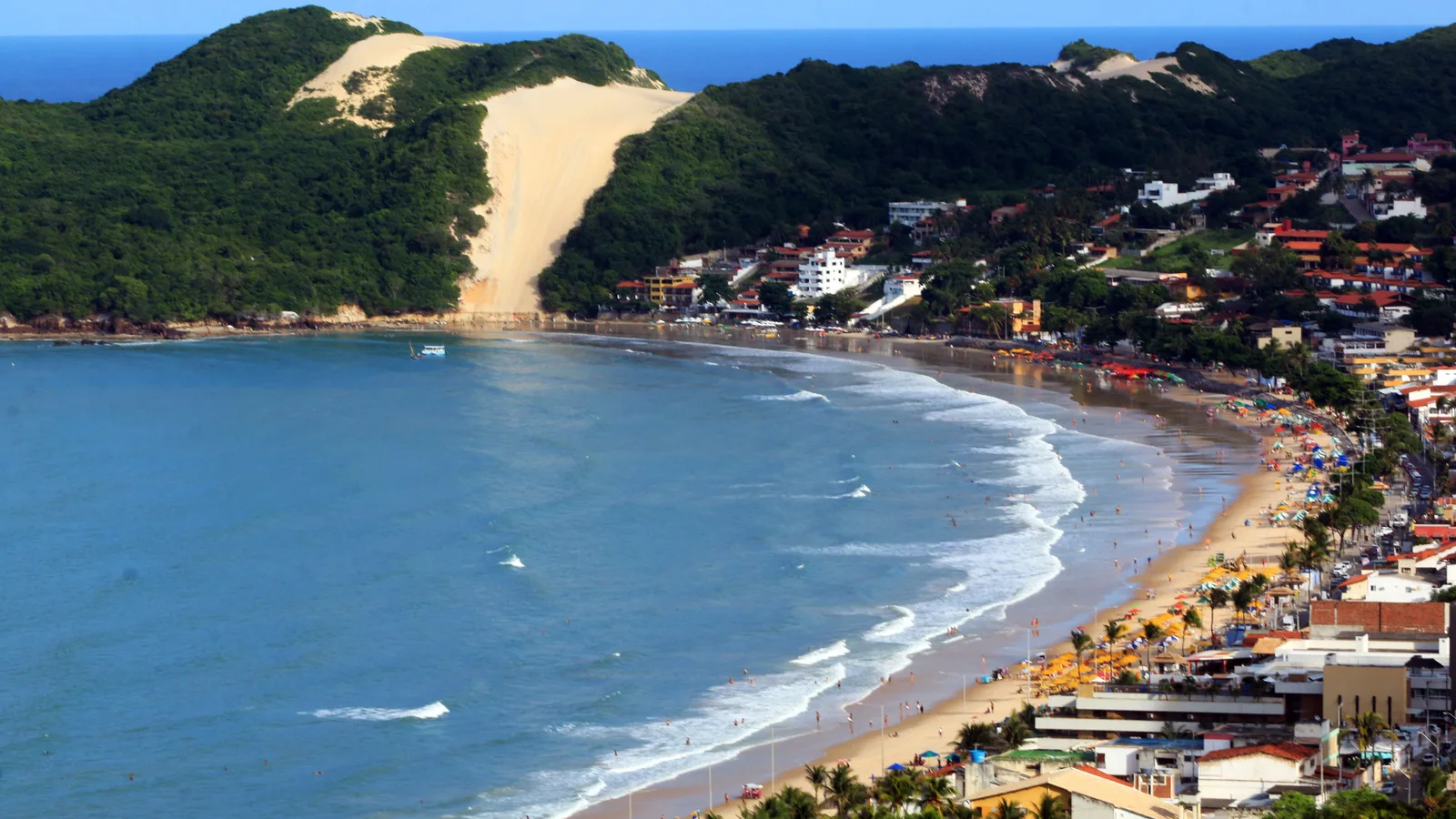
Ponta Negra in Natal from above: a curved beach lined with umbrellas and low red-roofed buildings, with the green hill of Morro do Careca and its bare stripe of sand closing the far end, and blue water breaking along the shore

Rio Grande do Norte

Natal

Brazil’s sunniest coastal city, with a wall of moving sand just outside it.

Last checked September 2026

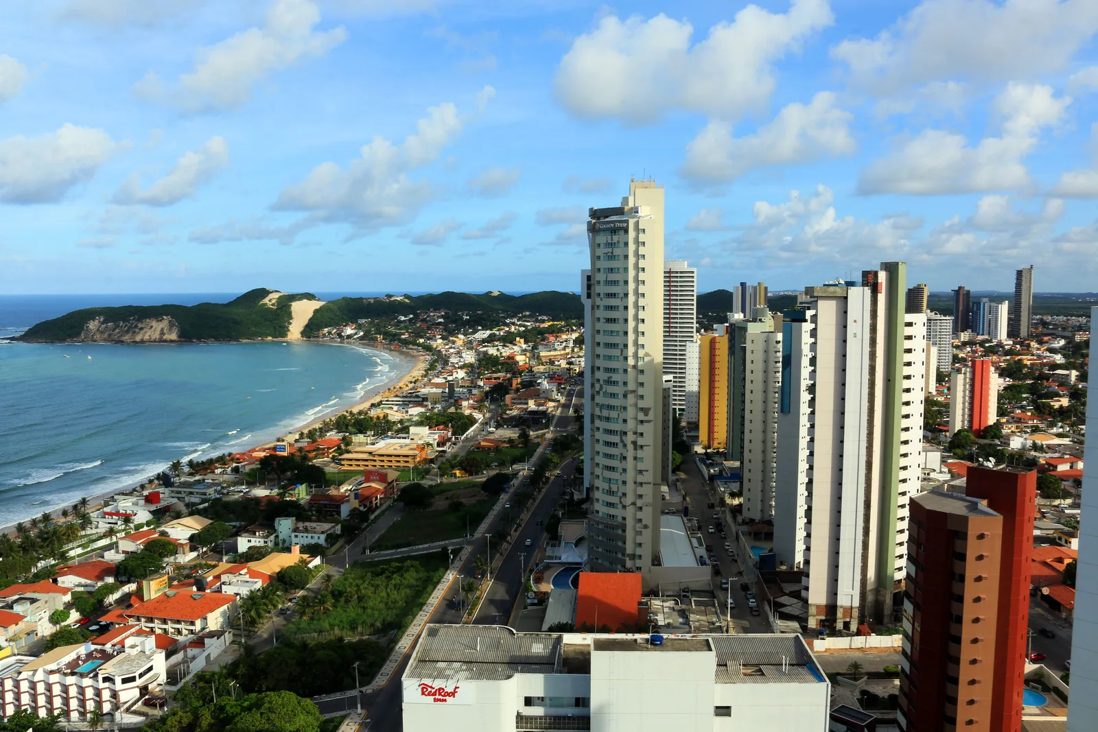
  • Ponta Negra seen from high beside its apartment towers, the beach curving away to the green headland of Morro do Careca
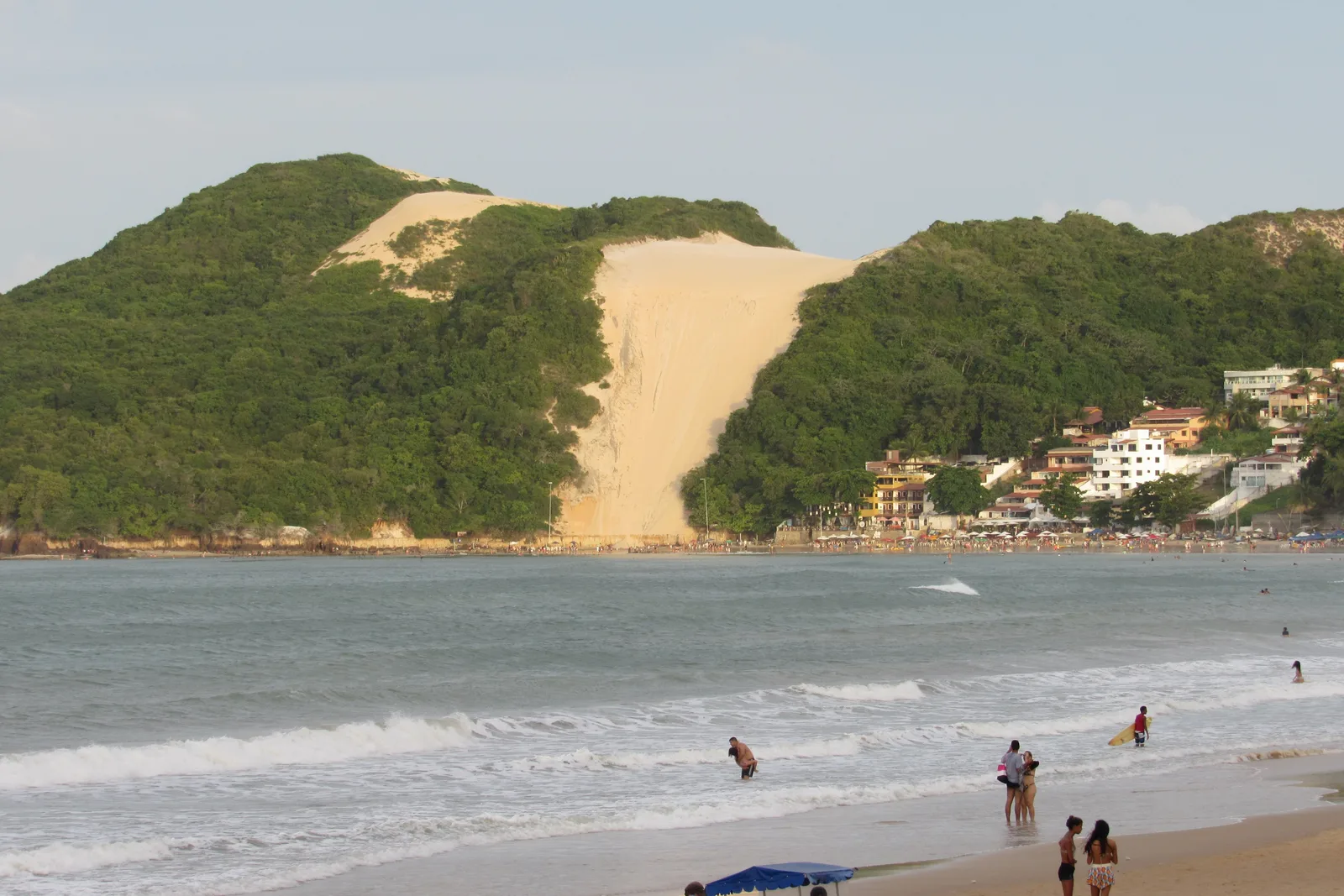
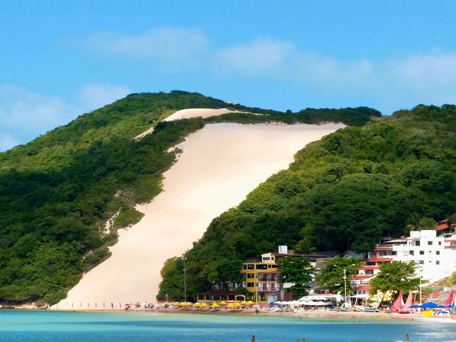
  • Morro do Careca from the beach at Ponta Negra: a green hill split by a bare slope of pale sand, with people standing in the shallows below
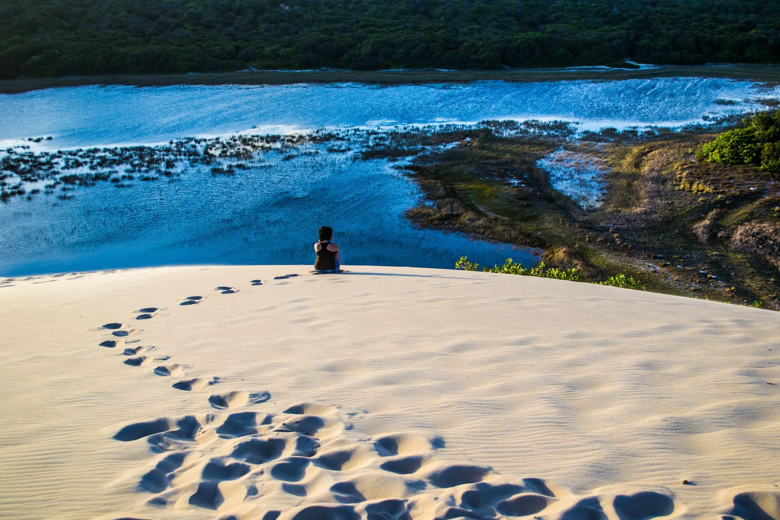
  • A line of footprints crossing white sand at Jenipabu toward a person sitting on the dune crest above a blue lagoon, with a forested far shore
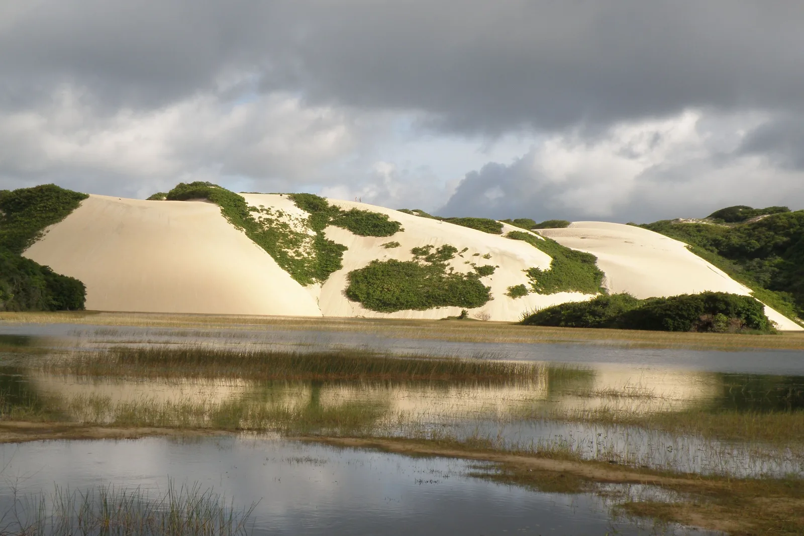
  • Pale dunes above a shallow reed-fringed lagoon at Genipabu in the late afternoon
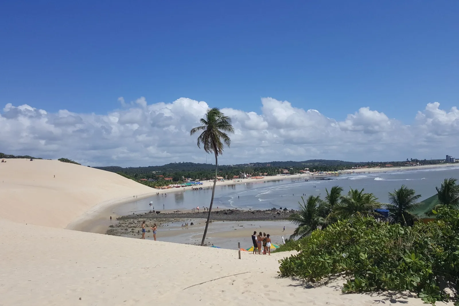
  • A dune slope running down to the beach at Genipabu, with a single tall leaning coconut palm, small groups of people on the sand and the curve of the bay beyond
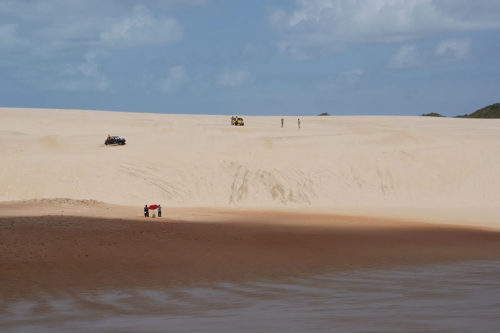
  • A wide sweep of pale dune with buggies and walkers reduced to specks on it, giving the scale of the sand field
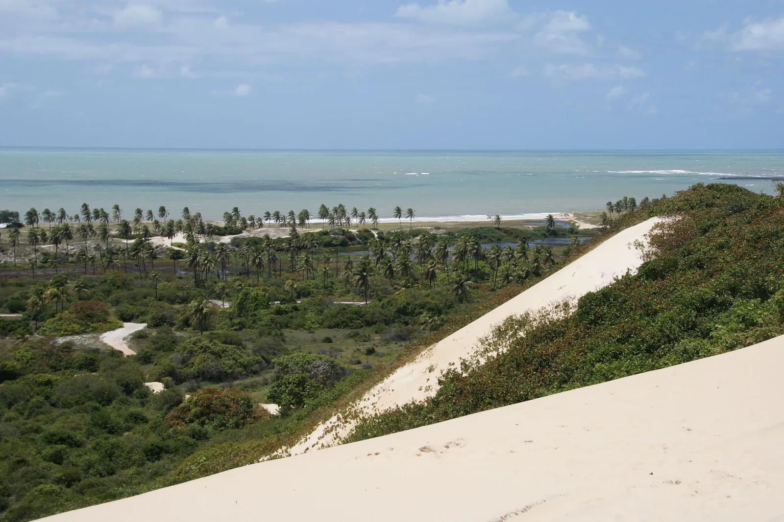
  • The crest of a dune above a coconut grove, with green water and a reef line beyond
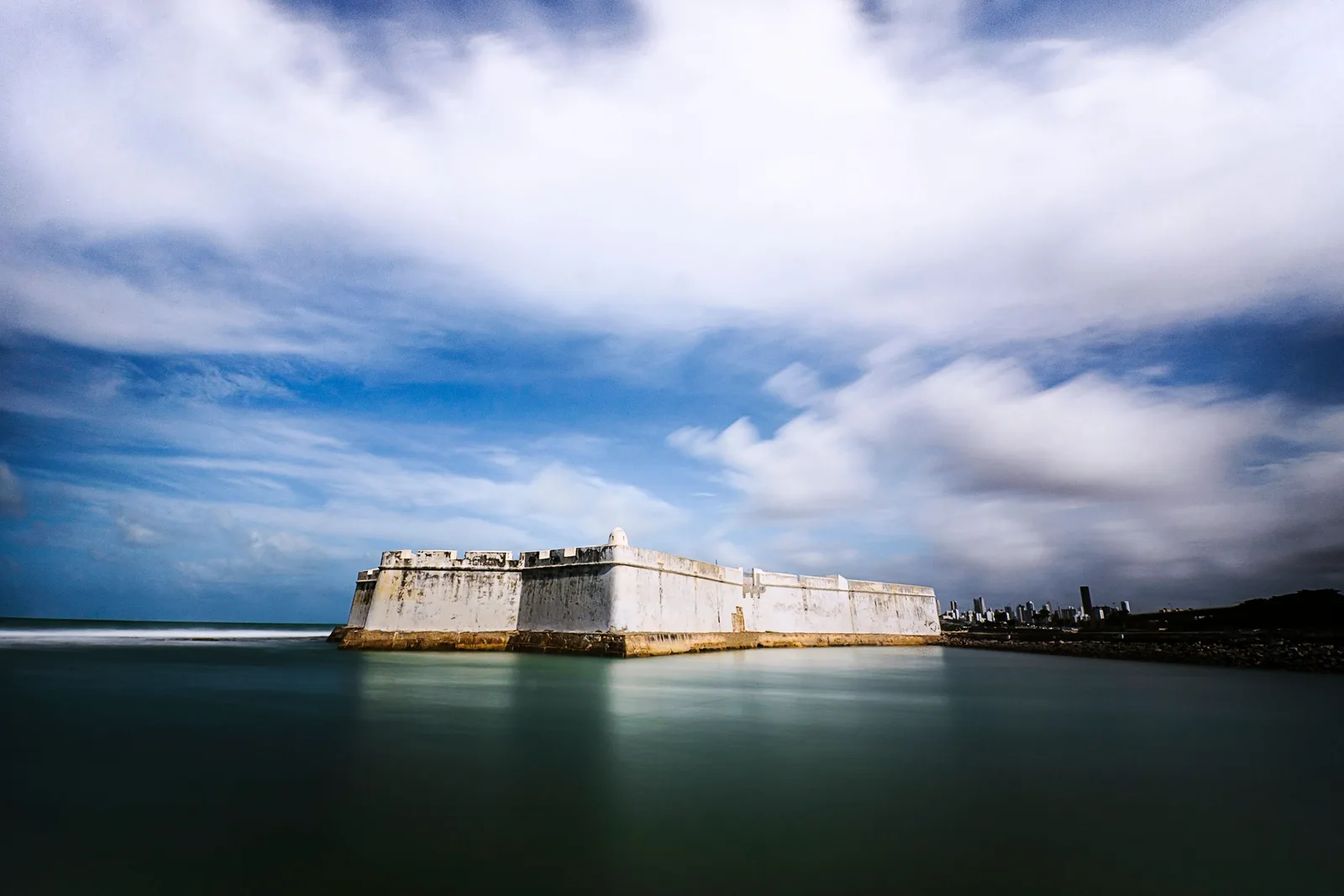
  • The low white walls of the Fortaleza dos Reis Magos seen across calm water under a bank of cloud, with the Natal skyline to the right
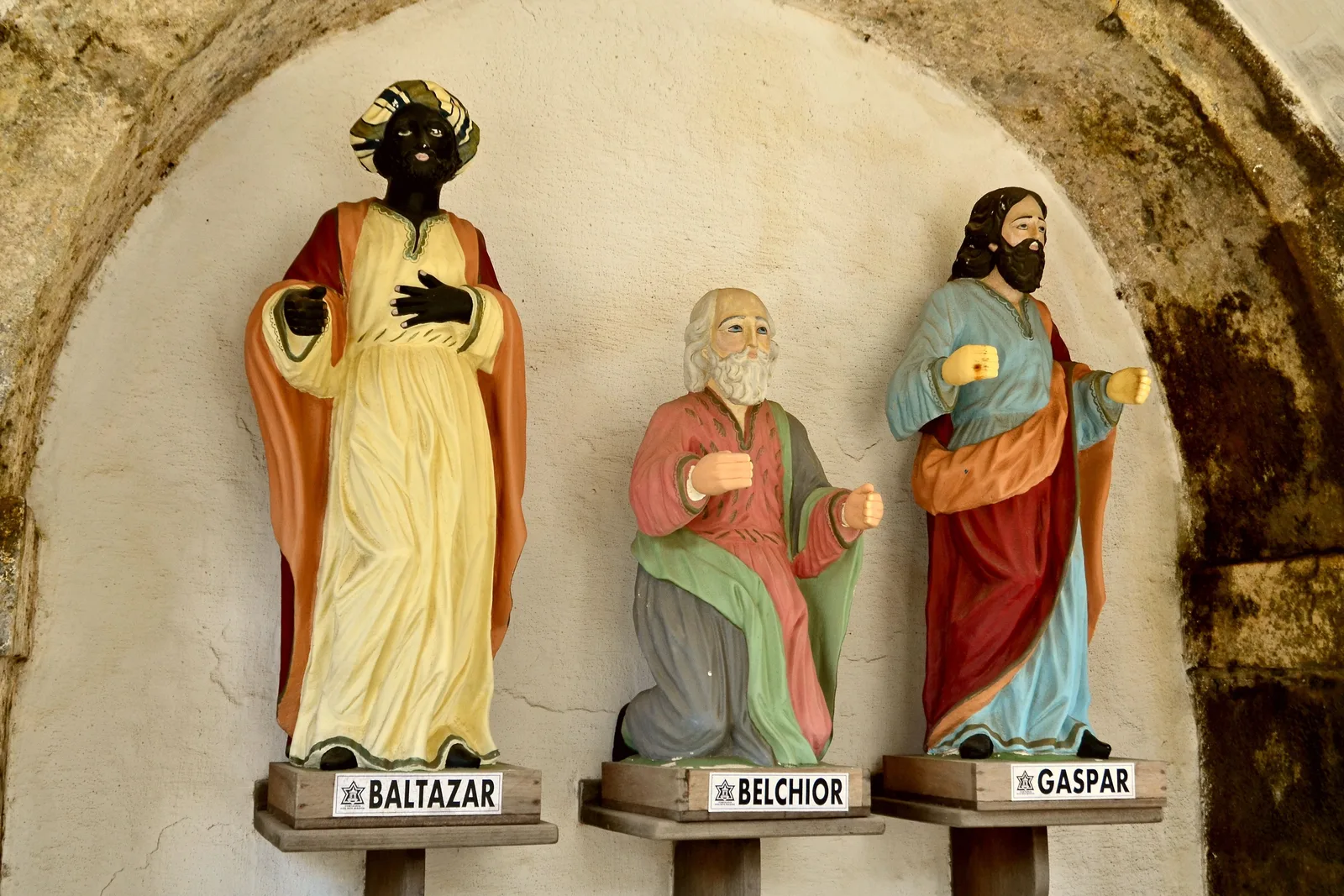
  • Painted statues of the three Magi on labeled pedestals, Baltazar and Gaspar standing and Belchior kneeling between them, in an arched stone niche inside the Fortaleza dos Reis Magos
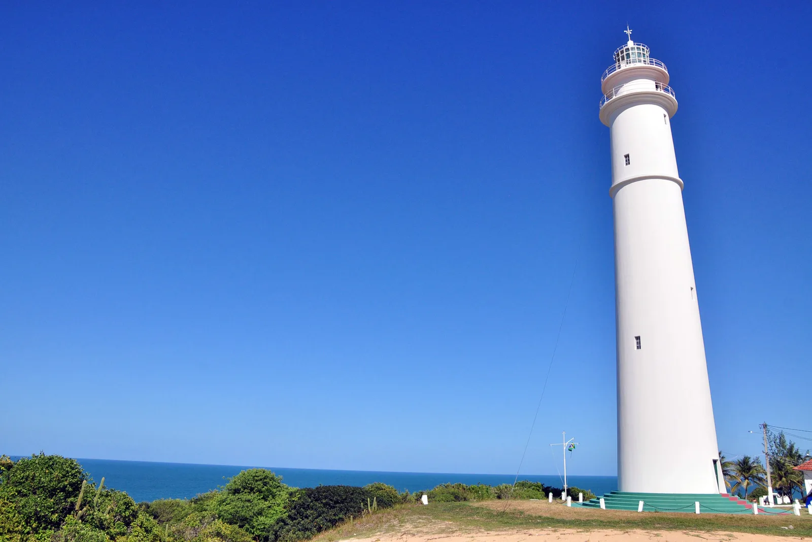
  • The white tower of the Farol de Mãe Luíza lighthouse against a clear blue sky, with green scrub and the sea at its foot
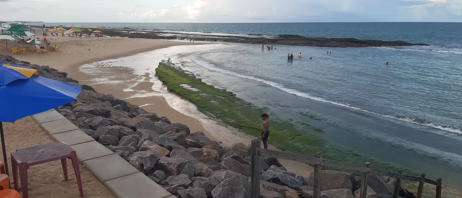
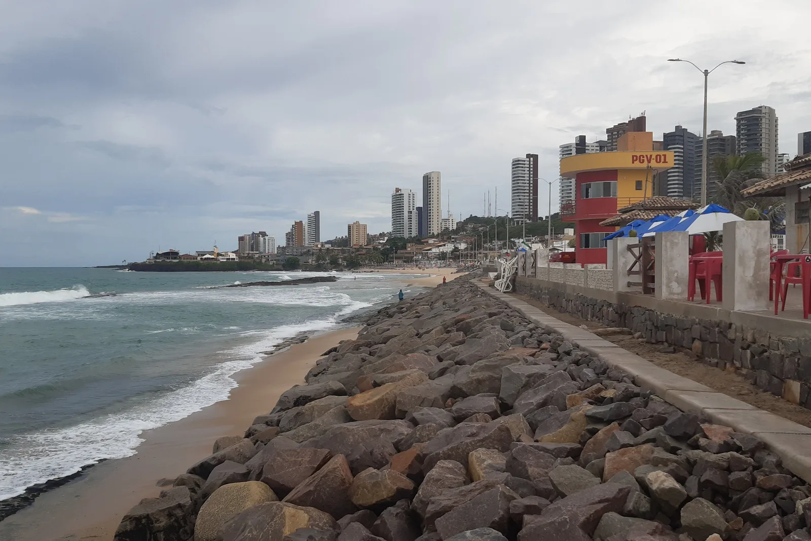
  • A rock sea wall running along the sand at Praia do Meio in Natal, with surf breaking beside it, a red and yellow lifeguard tower, kiosk tables and the city’s apartment towers behind
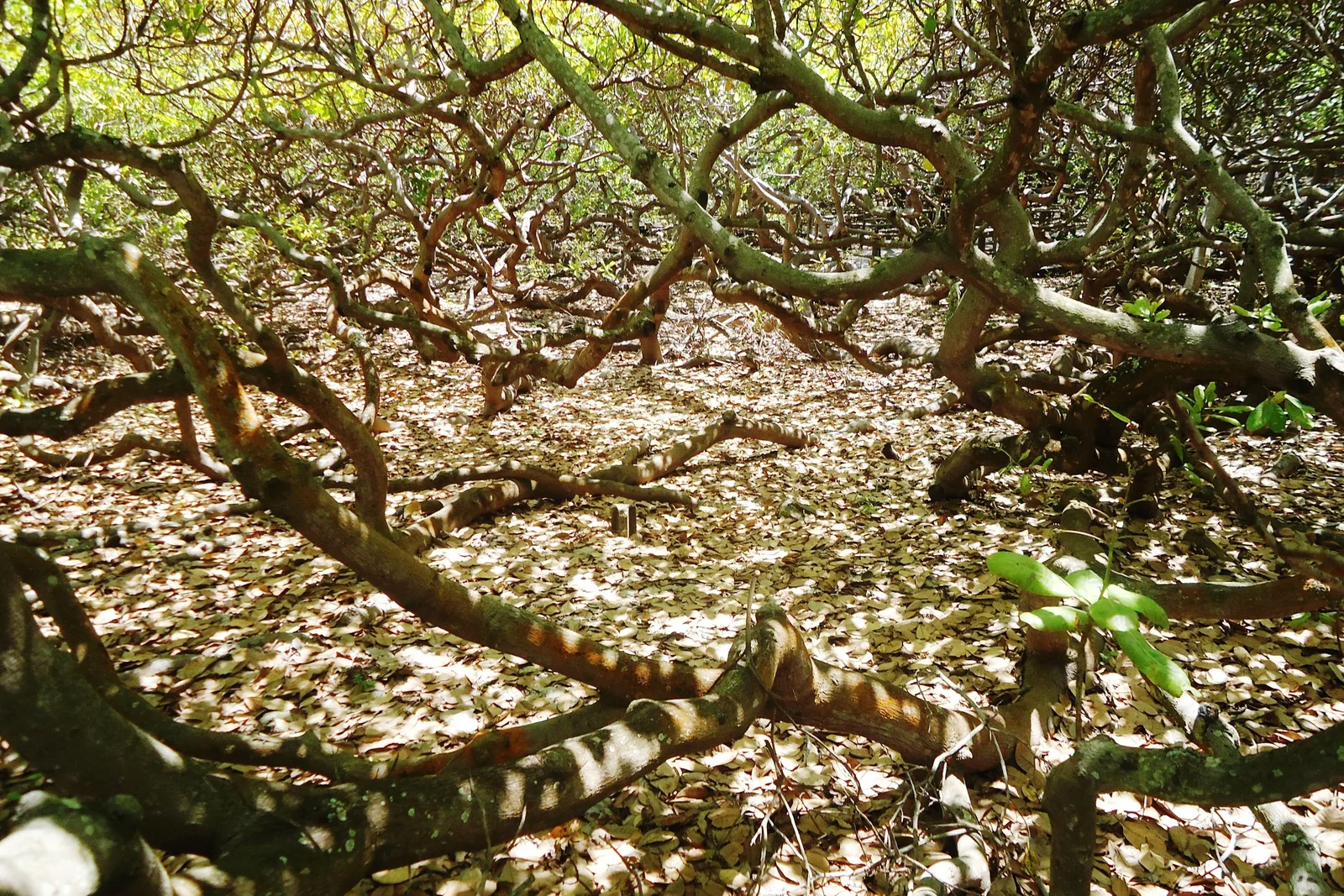
  • The tangle of low horizontal branches of the Pirangi cashew tree, spreading out across the ground and rooting where they touch

Quick Facts

What you need to know about Natal

The capital of Rio Grande do Norte sits on the corner of Brazil, where the coast stops running north and starts running west. It is a working city of about 750,000 people with an international airport, a long city beach, and a dune field on its doorstep that most visitors come for.

Overview

Why Natal and not one of the other six

Brazil’s northeast coast has a lot of good beach cities, and from a distance they look interchangeable. Natal is separated from the rest by two things you can put a number on.

The first is sunshine. INMET, the national weather service, records 2,979.8 hours of sun a year at its Natal station on the 1991-2020 normals. Of the 111 stations in that table with a complete annual figure, only four beat it, and all four sit deep in the semi-arid interior. Fortaleza gets 2,845.9 hours, Recife 2,502.3, Salvador 2,372.8. No coastal city in the country is sunnier than this one.

The second is the sand. A live dune field starts about 15 km north of the city center at Genipabu and runs on up the coast in ridges tall enough to swallow a vehicle. It is inside a state protected area, it is crossed by licensed buggy drivers, and it is close enough that you can be on it an hour after landing.

The third fact is the one the brochures leave out, and it is the reason the first two exist. The southeasterly trade blows harder here than in the other northeastern capitals: INMET puts the annual mean at 4.2 meters a second against 2.9 in Fortaleza, 2.4 in Recife and 1.6 in Salvador. It is what piles the sand up, it is what keeps the sky clear, and from August to November it will also blow your umbrella over.

Getting here

The airport, and how far it is from the sea

Aeroporto Internacional de Natal, code NAT, is in São Gonçalo do Amarante, and it is not in Natal. It replaced the old city airport in 2014 and it sits well inland of everything you came for, so build the transfer into your first day and your last.

  • The airport operator puts it 30 km from downtown Natal. Ponta Negra, where most visitors stay, is about 35 km by road, and the transfer takes about 45 minutes.
  • Five airlines fly scheduled services here: Azul, GOL, LATAM, JetSMART and TAP Air Portugal. TAP’s Lisbon flight is the only scheduled service to another continent.
  • There is no nonstop from North America. Americans connect through a Brazilian hub, usually São Paulo or Brasília, or fly TAP through Lisbon.
  • Zurich Airport Brasil took over the terminal in February 2024 under a 30-year concession, the first re-tendered airport in the country.
  • Ride apps work from the terminal and are the cheapest way in. A rental car is worth it only if you plan to drive the coast yourself, because the dune trips are all done by buggy with a driver anyway.
  • Getting around town: the beachfront neighborhoods are walkable inside themselves and a long way from each other. Ride apps between them cost a few dollars and everyone uses them.

Costs

One of the cheaper capitals on the coast

The beach is free, the tourist attractions are priced in single-digit dollars, and the two things that will actually move your budget are the flight and the buggy day.

Estimated daily budget, per person

Budget

$50 / day

A simple pousada a street back from Ponta Negra, kiosk and barraca meals, ride apps, the city beaches and a shared seat on one buggy trip.

Mid-range

$105 / day

A sea-view room at Ponta Negra or on the Via Costeira, restaurant dinners, a private buggy day and a boat trip to the reefs.

Comfortable

$215 / day

A resort room on the Via Costeira, private transfers, a guided day on each coast and the diving rather than the snorkeling.

Per person per day once you are in Natal, flights not included. Two people sharing a room lands well under double one person’s figure.

What things cost

  • Sea-view mid-range room at Ponta Negra, per night $65 R$330
  • Simple pousada a street back from the beach, per night $31 R$160
  • Fortaleza dos Reis Magos entry $2 R$10
  • Maior Cajueiro do Mundo entry at Pirangi $2 R$10
  • Shared buggy day on the north coast, per person, plus about R$25–30 in ferry and dune fees $33–35 R$170–180
  • Private buggy for four, north coast, whole vehicle, plus about R$90–120 in ferry and dune fees $129 R$660
  • Maracajaú catamaran with mask and snorkel, per person $24 R$120
  • Guided scuba dive on the parrachos, per person $31 R$160
  • Ginga com tapioca from a beach stall $3 R$15
  • Lunch for two on the Ponta Negra seafront, with beer $29 R$150
  • Ride app, airport to Ponta Negra $18 R$90
  • Rental car, per day $24 R$120

Two published prices on this list. The state culture foundation set the Fortaleza dos Reis Magos ticket at R$10 from 1 February 2025, with free entry for residents of Natal and half price for students and over-60s. IDEMA, the state environmental agency, set the cashew tree’s at R$10 from November 2025, paid by card, not cash. Everything else is an estimate or an operator’s listed rate.

The buggy figures are the ones operators advertise, and they vary by season and by how much of the north coast you cover. The ferry across the Ceará-Mirim and the dune-park fees are charged on top. A shared seat and a whole vehicle are two different products: four people in a private buggy costs less per head than four shared seats.

Cards work almost everywhere, including the cashew tree, which takes no cash. Carry small notes for beach vendors, the dune fees and the ferry across the Ceará-Mirim river on the north coast run.

Checked September 2026 and converted at R$5.10 to the dollar, the rate every page on this site uses. Two published prices and ten estimates, so read this as the shape of a budget rather than a quote anyone can be held to.

Safety

A bad year for the state, and a beachfront that is fine

6 /10

Our rating: a state whose violent-death rate jumped in 2025, and a compact, busy visitor strip.

Rio Grande do Norte recorded 29.1 intentional violent deaths per 100,000 people in 2025 against a Brazilian national rate of 19.1, and its rate rose 19.6 percent in a year, the largest increase of any state in the country, while Brazil as a whole fell 8.2 percent. Those figures come from the 20th Anuário Brasileiro de Segurança Pública, published by the Fórum Brasileiro de Segurança Pública in July 2026 and reported by both CNN Brasil and Agora RN, which attribute the rise to conflict between criminal factions. That is a real problem and it is worth knowing about. It is also, as in every Brazilian capital, concentrated in neighborhoods no visitor has any reason to enter. Ponta Negra is compact, busy and floodlit, the Via Costeira is a strip of hotels, and the fort and the old beaches are daytime places.

  • Stay on the lit, busy stretches after dark. Ponta Negra’s beachfront is fine at night; the streets climbing the hill behind it are quieter and less so.
  • The old city beaches, Praia do Meio, Praia dos Artistas and Areia Preta, are pleasant by day and empty out at night. Treat them as a daytime destination.
  • Take a ride app rather than walking between beach districts. They are further apart than the map suggests and the routes between them are not pedestrian ground.
  • Ordinary beach sense applies. Take one card, a little cash and a cheap phone to the sand, and leave the rest in the room.
  • On the water, the risk is the sea rather than anyone in it. The open beaches have real surf; swim near a lifeguard post and read the flags.

On the map

The corner of the continent

Natal sits at the northeastern tip of South America, on the south bank of the Potengi river where it meets the Atlantic. It is the closest Brazilian capital to Africa, which is why the Americans built an air base here in the Second World War. Recife is about 300 km south, Fortaleza about 520 km northwest.

Natal Natal

5.79° S, 35.21° W

See Natal on the Brazil map

The Landmarks

Five things worth the trip

Natal’s sights are not architecture, with one four-hundred-year-old exception. They are a hill of sand, a field of it, a reef that surfaces at low tide, and a tree the size of a city block.

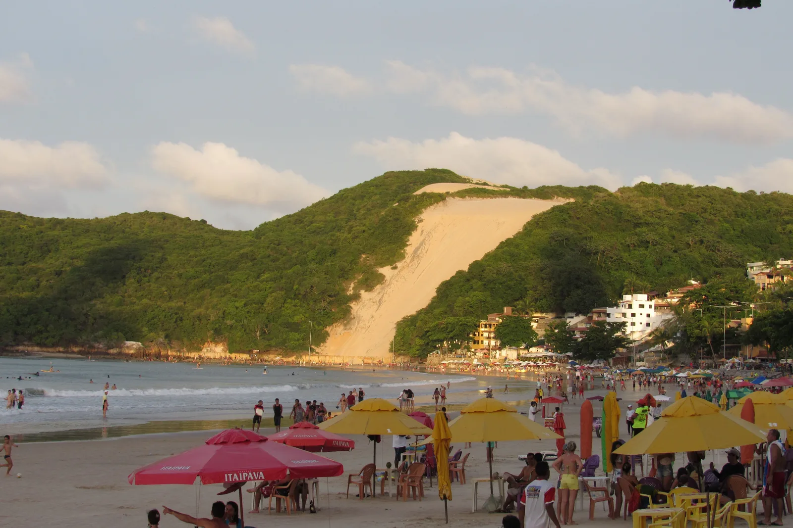
Morro do Careca at the end of Ponta Negra beach: a rounded hill covered in green scrub with a wide bare slope of pale sand running down its face to the buildings and turquoise water at its foot 01

The city beach

Ponta Negra and Morro do Careca

The dune
About 64 m
Sand fill
4.6 km (2025)
Climbing
Closed since the 1990s

Ponta Negra is Natal’s beach in the way Copacabana is Rio’s: the one with the hotels behind it, the kiosks along it and the postcard at the end. The postcard is Morro do Careca, a dune of about 64 meters wedged between two green flanks at the southern end of the sand, and it is the image on every fridge magnet in the state.

You cannot climb it. It was closed to visitors in the late 1990s and fenced after uncontrolled foot traffic stripped the vegetation holding the slope together, and researchers at the Federal University of Rio Grande do Norte have since measured the dune losing height. What you do is look at it, which is what the whole beach is arranged to do.

The beach itself is wider than it was. Natal’s city government finished a 4.6 km hydraulic fill in January 2025, moving about 1 million cubic meters of sand and adding up to 100 meters of beach at low tide and 50 at high. Photographs taken before September 2024 show a different, much narrower shore.
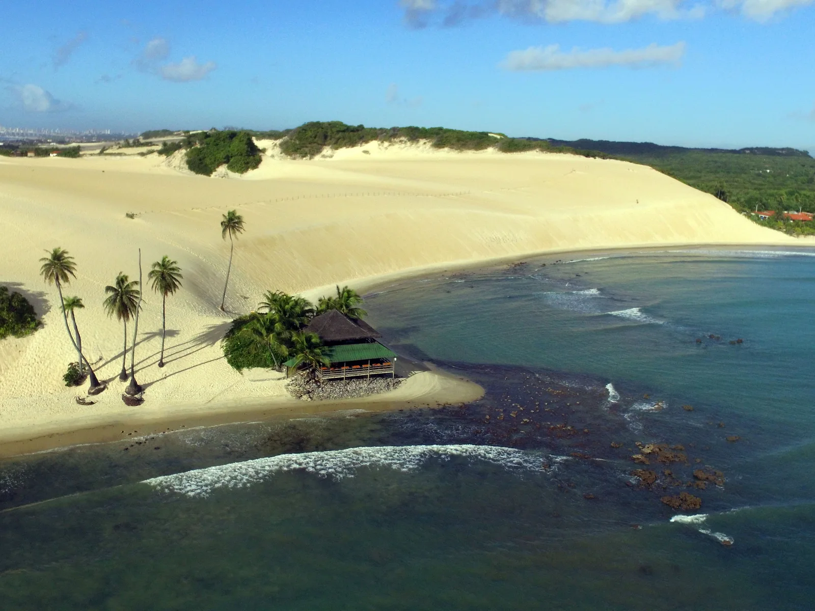
Aerial view of the Genipabu dunes: broad pale sand ridges running down to a fringe of coconut palms, a thatched shelter and shallow green water broken by dark reef 02

The dunes

The Genipabu dune field

From Natal
About 15 km north
Municipality
Extremoz
Status
State protected area

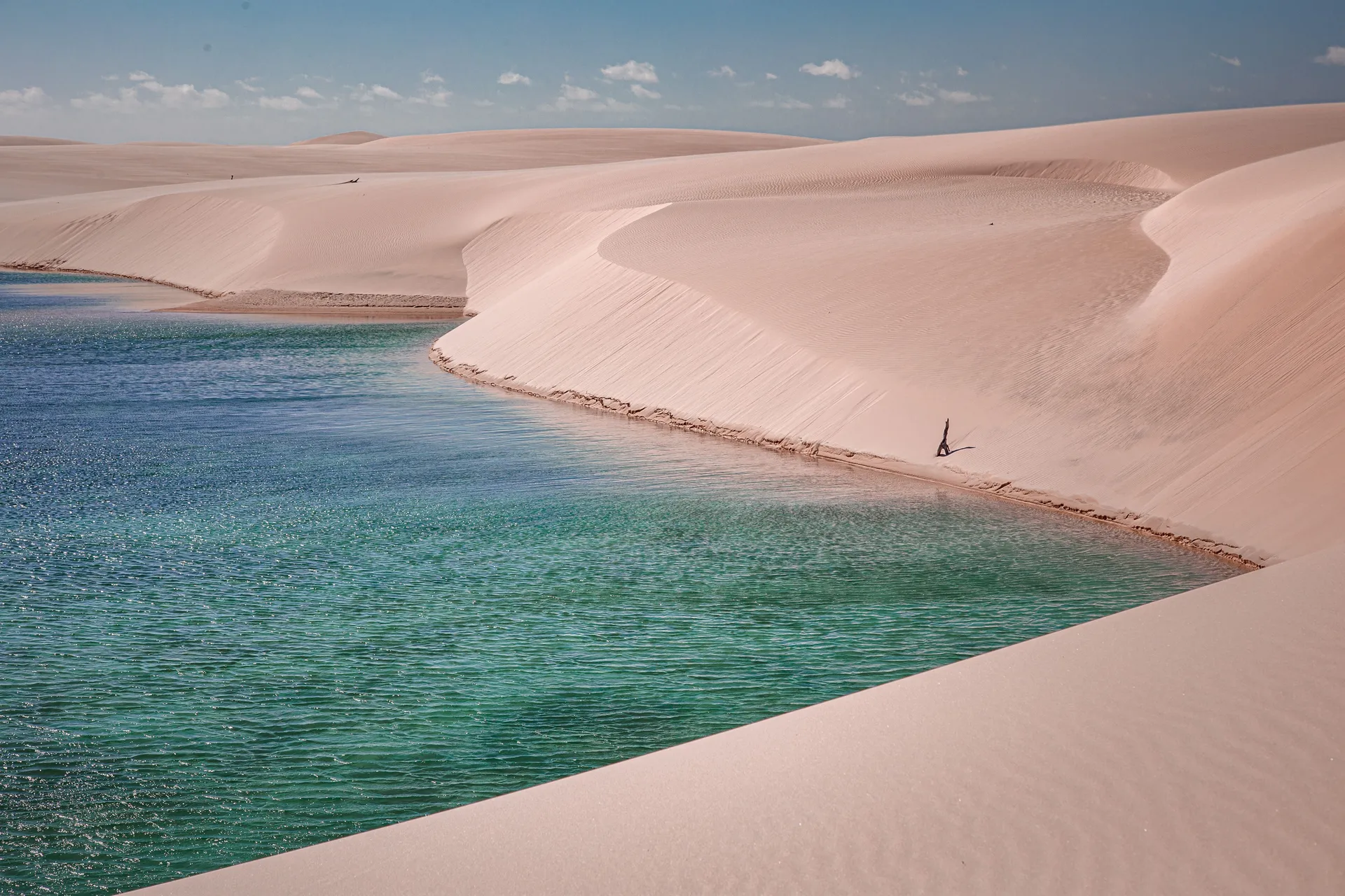
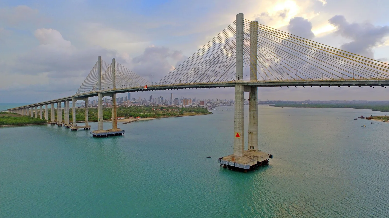
Fifteen kilometers north of the center, past the Newton Navarro bridge and the north-shore beaches, the coast turns into a sea of moving sand. The dunes at Genipabu are the reason most people come to Natal, and they are genuinely mobile: the ridges shift with the trade wind, so the shape of the place is not the shape it had last year.

The field sits inside the Área de Proteção Ambiental de Jenipabu, a state-level protected area in the municipality of Extremoz, and you do not simply drive onto it. Access is by licensed buggy on marked tracks: drivers are credentialed by the state, and the tours are registered with IDEMA, the state environmental agency. The same trip usually takes in the freshwater lagoons behind the dunes, Pitangui and Jacumã, where the sand meets standing water.

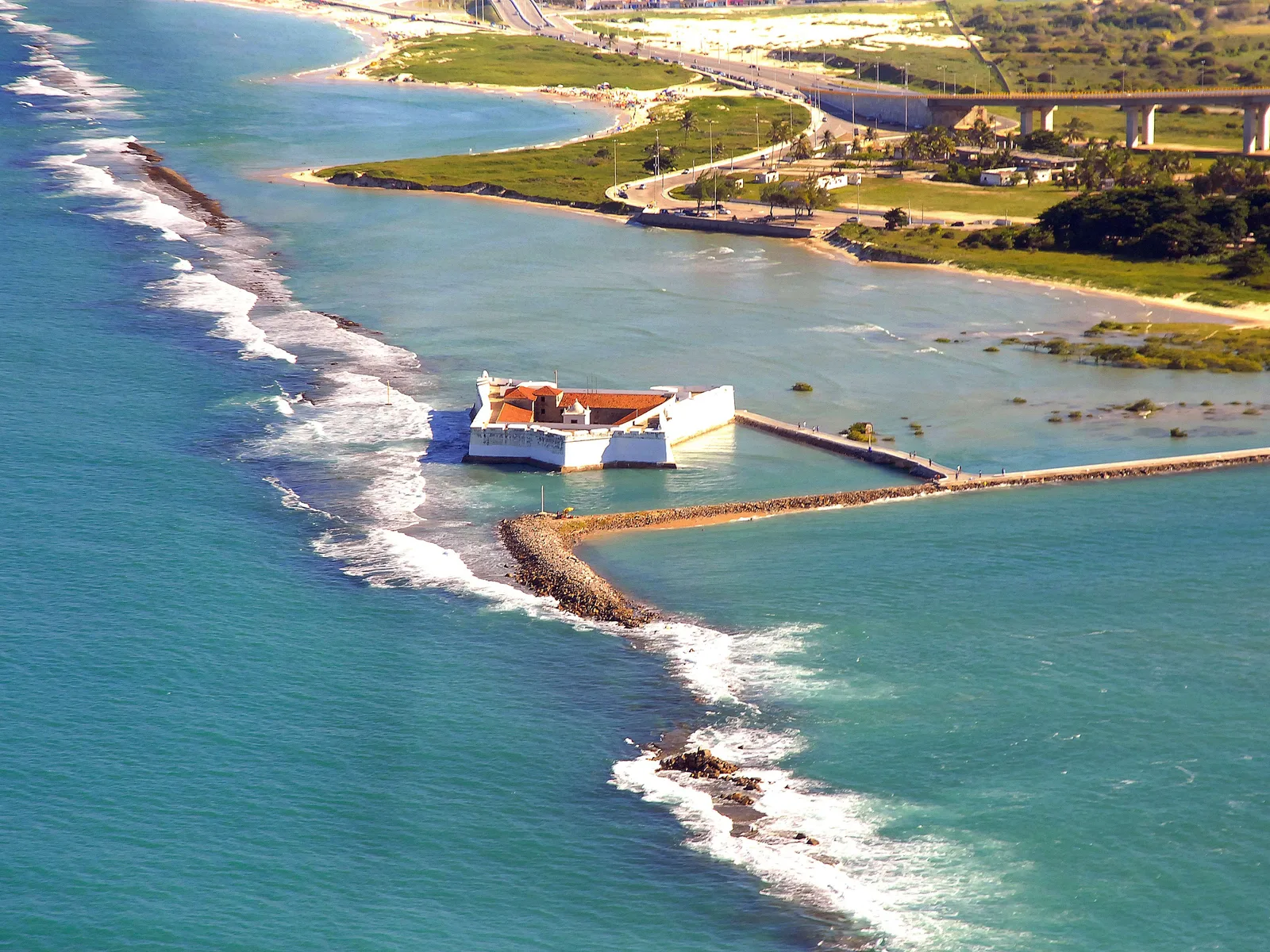
Aerial view of the Fortaleza dos Reis Magos: a low white fort with red-tiled roofs inside its walls, standing in green water at the river mouth and joined to the shore by a long walkway, with surf breaking on the reef beside it and the Newton Navarro bridge behind 03

The fort

The Fortaleza dos Reis Magos

Begun
6 January 1598
Open
Tuesday to Sunday
Entry
R$10

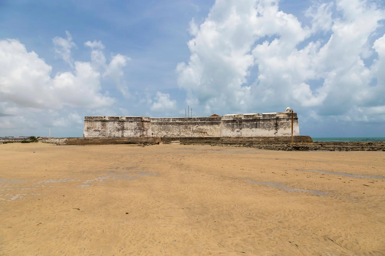
A five-pointed star fort standing on a reef at the mouth of the Potengi, joined to the shore by a causeway that the tide half covers. Construction started on 6 January 1598, the feast of the Epiphany, which is where both the fort and the city get their names: the Reis Magos are the three Magi, and Natal is Portuguese for Christmas.

The fort came first and the city followed. Natal was founded on 25 December 1599, a year and eleven months later, on the strength of the garrison already sitting in the river mouth. Portugal built it in earth, rebuilt it in stone after 1608, lost it to the Dutch, and got it back.

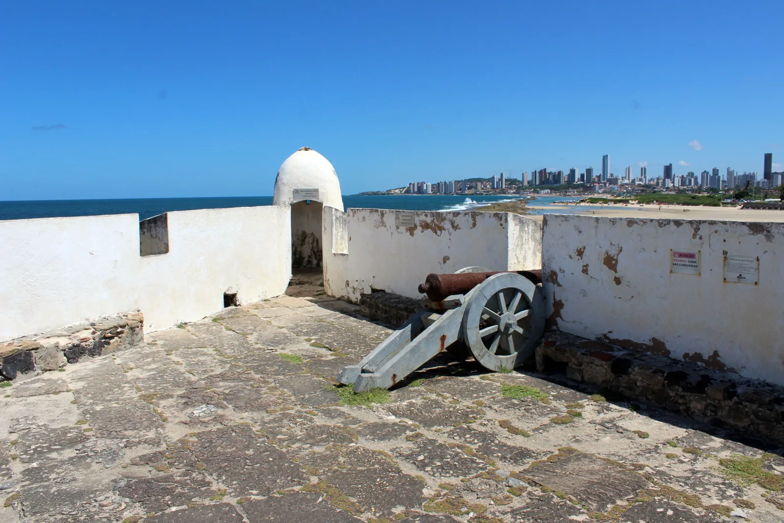
It closed for restoration in 2018 and reopened in December 2021. Inside there are cannon on the terreplein, a chapel, a freshwater cistern and painted statues of Baltazar, Belchior and Gaspar in a niche. The view back across the water at the Natal skyline is the reason to climb the ramparts.

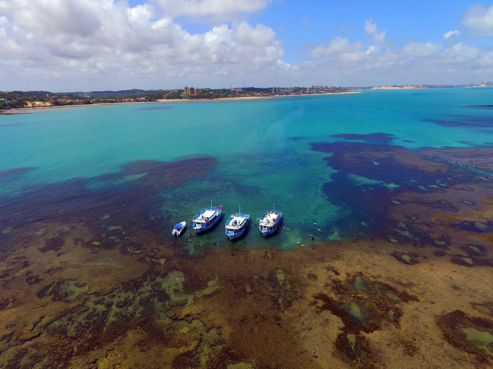
Aerial view of the parrachos off Pirangi: turquoise shallow water over dark patches of reef, with three double-deck tour boats and a small speedboat moored at the reef edge and the beach and low buildings behind 04

The reefs

The parrachos

Protected area
Created 2001
Size
About 136,000 ha
Reached at
Low tide only

Parracho is a local word for a shallow biogenic reef that stands proud of the water when the tide drops. Rio Grande do Norte has a string of them, and the state protected them in 2001 as the Área de Proteção Ambiental dos Recifes de Corais, roughly 136,000 hectares along the coast of Maxaranguape, Rio do Fogo and Touros. It is the largest state conservation unit in Rio Grande do Norte and the only one entirely at sea.

The one everyone visits is Maracajaú, about 55 km north of Natal, where the reef sits 5 to 7 km offshore and boats run out to it in around half an hour. On a low tide the water over the coral drops to between one and three meters and turns the color of a swimming pool. There are more parrachos at Pirangi, much closer to the city on the south side.

The tide, not the calendar, decides whether you go. Operators sail on the low water, so the departure time moves through the day across the month and a trip that leaves at 8:00am one week leaves at 2:00pm the next. Book on a date, not on a time, and expect the time to be given to you.

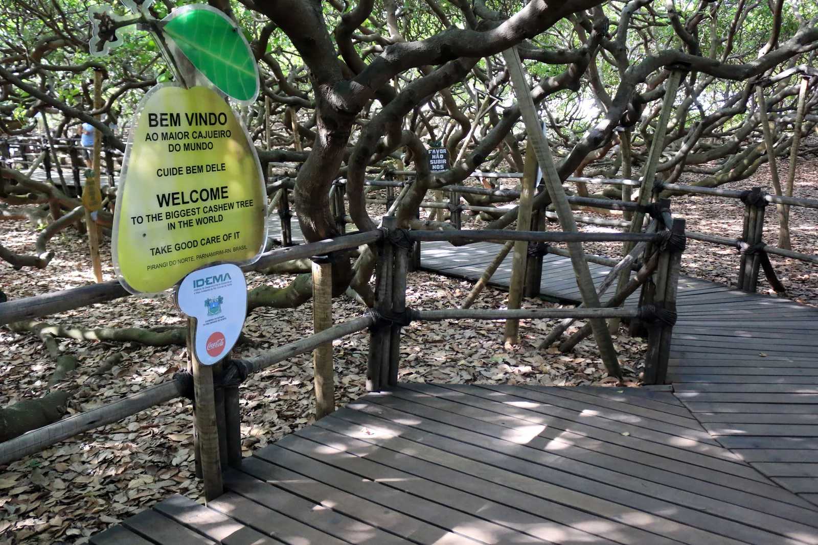
A wooden boardwalk running under the Pirangi cashew tree, with a yellow-green cashew-shaped welcome sign on a post and gray twisting limbs crossing overhead and along the ground on both sides 05

The oddity

The cashew tree at Pirangi

Canopy
About 8,500 m²
Branch spread
Some 50 m
From Natal
About 25 km south

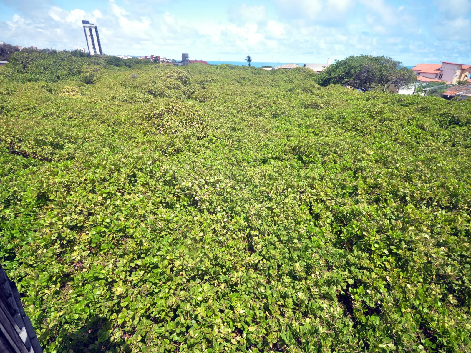
At Pirangi do Norte, in Parnamirim just south of the city, there is one cashew tree that covers about 8,500 square meters. Guinness World Records lists it as the largest cashew tree in the world, with limbs radiating some 50 meters out from the central trunk. That is roughly the footprint of a city block, grown by a single plant.

It works because of a genetic quirk. The branches grow outwards rather than upwards, and where a branch touches the ground it puts down roots and carries on as if it were a new trunk, so the tree keeps walking outwards instead of getting taller. Standing under it feels like standing in a low wood rather than beside a tree.

There is a raised boardwalk through the middle of it, a viewing platform, and stalls selling cashew everything. Allow forty minutes. It is open daily from 8:00am to 5:30pm except on election days, and the R$10 ticket is paid by card, not cash.

Best Things to Do

What people actually do in Natal

Roughly in the order visitors do them: get on the dunes, get on the water, and then look at the city that got built between the two.

Dunes and Buggies

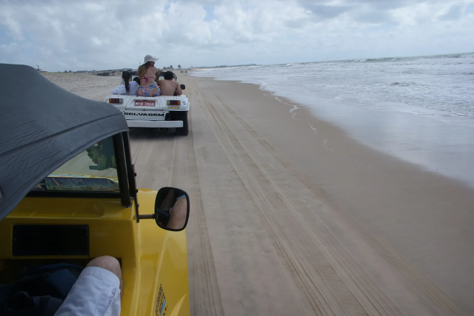
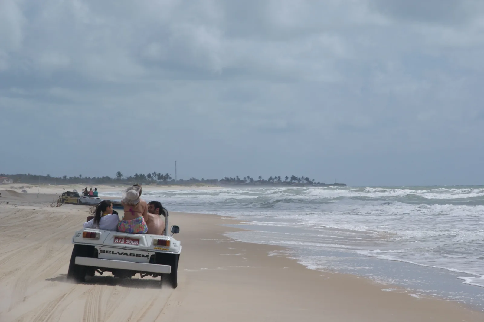
  • View forward from inside a yellow beach buggy with its roof up, following another buggy along a wide flat beach beside the surf

    Half day to full day · From Ponta Negra

    Buggy run at Genipabu

    The signature trip and the reason the buggy exists in Natal. A licensed driver takes up to four passengers north from the city over the Newton Navarro bridge and off the road onto the Genipabu dunes, then across the Ceará-Mirim river on a small raft ferry to the lagoons beyond. Drivers are accredited by SETUR, the state tourism department. Somewhere on the first ridge yours will ask whether you want the ride com emoção or sem emoção, with excitement or without. Answer honestly.

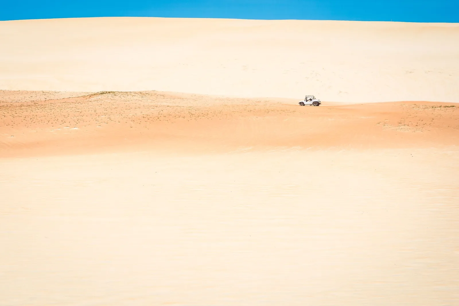
  • A single buggy crossing an enormous unbroken sweep of pale sand under a thin band of blue sky, small enough in the frame to show the size of the dune

    Included in the full north-coast run

    Dune driving at Pitangui and Jacumã

    Beyond Genipabu the field keeps going, and the longer version of the trip works north through the ridges to the freshwater lagoons at Jacumã and Pitangui. The scale only registers when a buggy two ridges away turns into a dot. This is also where the lagoon-side operators run their rope contraptions, the skibunda and the aerobunda, which send you down a sand face or across the water on a cable for about R$20 a go.

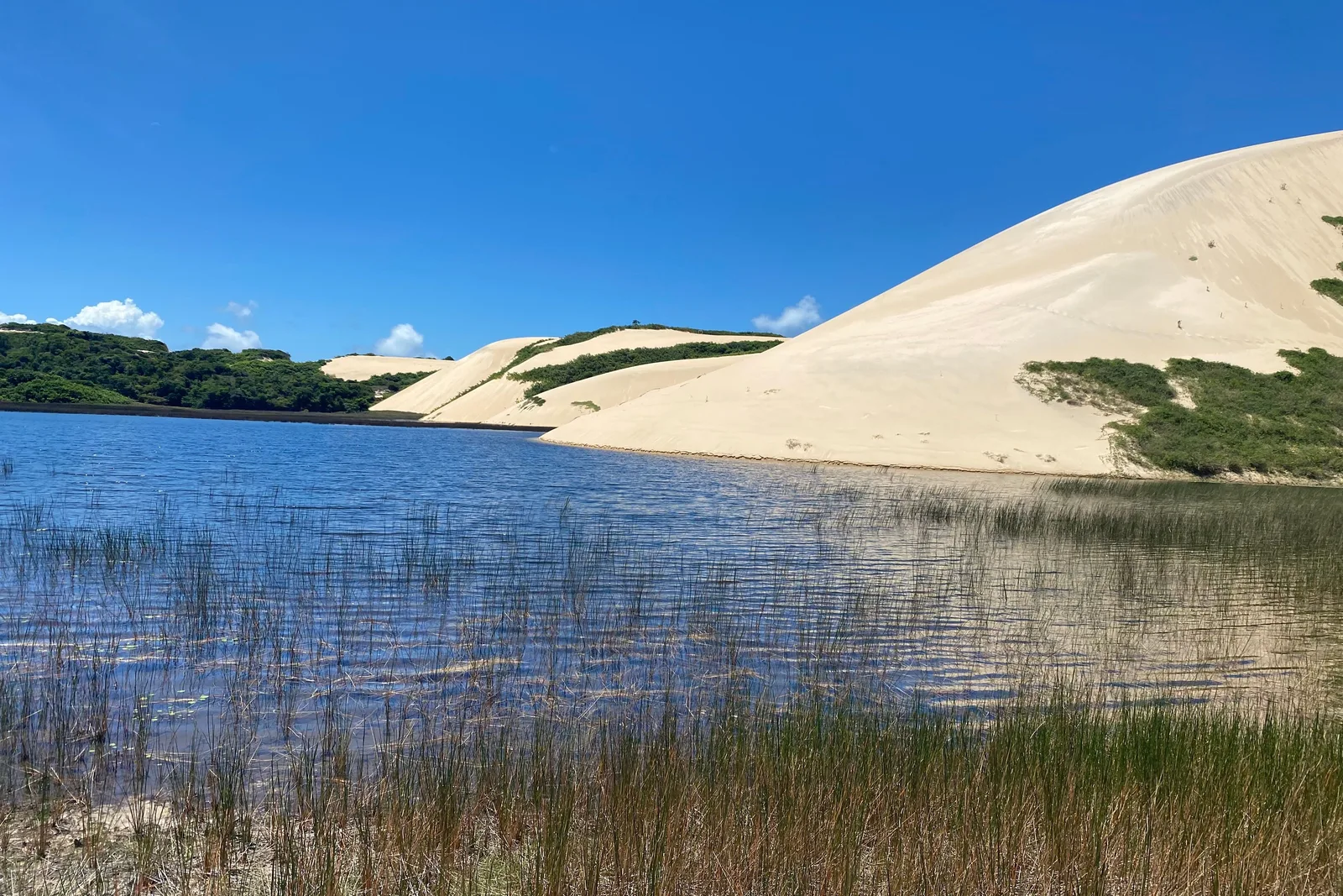
  • A pale dune ridge across the far side of a shallow lagoon, with clumps of reed in the foreground, under a deep blue sky

    Free · Fresh water · Best in the morning

    Swimming at the dune lagoons

    Behind the dune ridges the water table comes to the surface and forms shallow freshwater lagoons with sand walls rising straight out of them. They are warm, calm, and a genuine relief after a morning of salt and wind, and they are where the buggy runs tend to stop for lunch. Bring something to sit on: there is no shade except what the operators put up.

Sea and Reefs

  • A pale dune ridge across the far side of a shallow lagoon, with clumps of reed in the foreground, under a deep blue sky

    Free · Fresh water · Best in the morning

    Swimming at the dune lagoons

    Behind the dune ridges the water table comes to the surface and forms shallow freshwater lagoons with sand walls rising straight out of them. They are warm, calm, and a genuine relief after a morning of salt and wind, and they are where the buggy runs tend to stop for lunch. Bring something to sit on: there is no shade except what the operators put up.

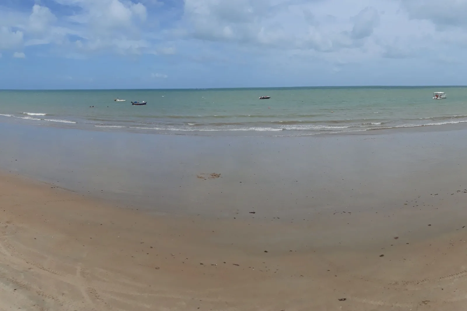
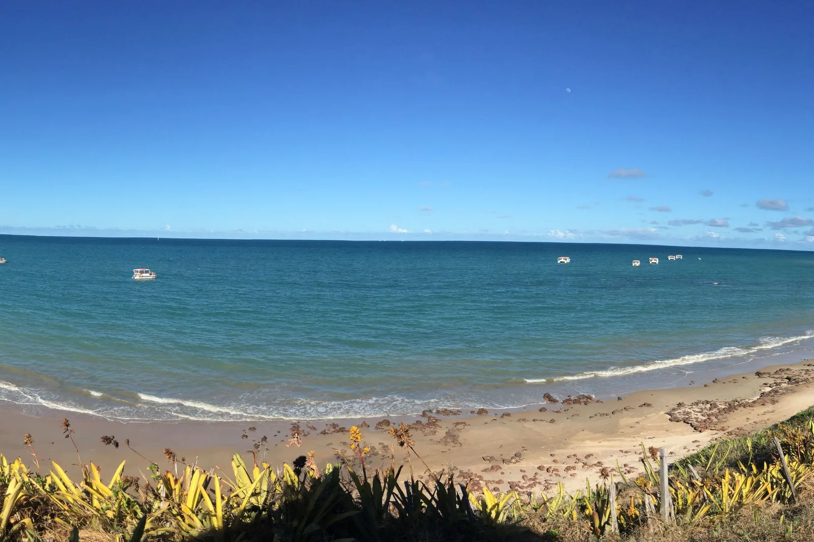
  • The beach at Maracajaú at low tide: a broad expanse of wet flat sand and shallow water with small boats moored far out toward the horizon

    Half day · Low tide only · About 55 km north

    Snorkeling the parrachos at Maracajaú

    Boats run 5 to 7 km offshore to the reef, and on a good low tide you swim over coral in water clear enough to read the bottom. The whole thing is tide-dependent, so the departure time is whatever the tide table says that day, and the reef is inside a state protected area with rules about touching and standing on it. The catamaran trip with mask and snorkel is the standard version; a guided dive with a tank is the upgrade.

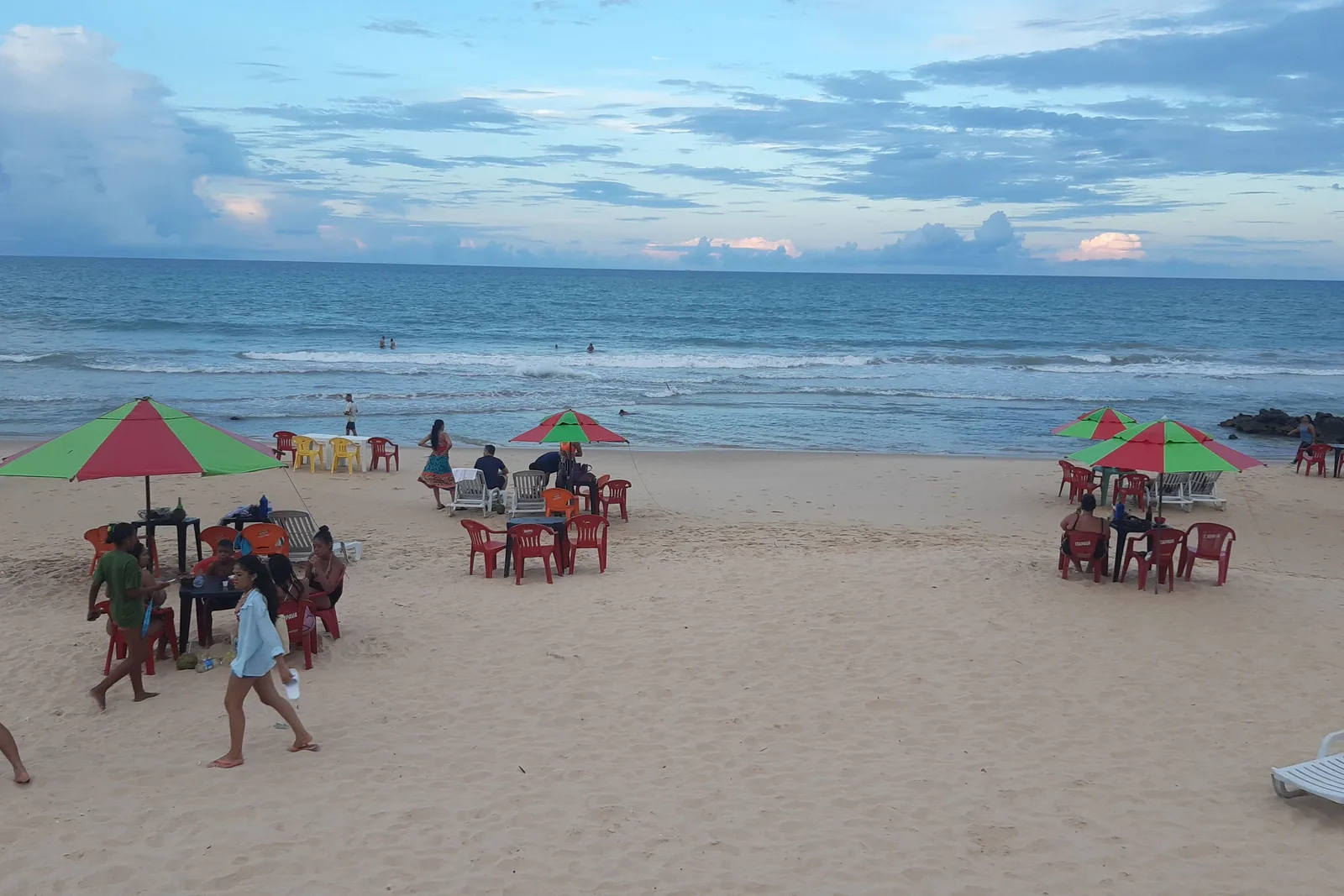
  • Red plastic tables and chairs under red and green umbrellas on the sand at Praia do Meio in Natal, with people walking at the water’s edge and dark rocks at the far end of the beach

    Free · Daytime

    A morning at Praia do Meio and Praia dos Artistas

    The old city beaches, below the Cidade Alta and within sight of the fort, are where Natal went to the sea before Ponta Negra existed. Rock groynes break the swell into a line of pools, kiosks put tables and umbrellas straight onto the sand, and the crowd is local rather than visiting. It is scruffier than Ponta Negra and it is a better window on the city. Daytime only.

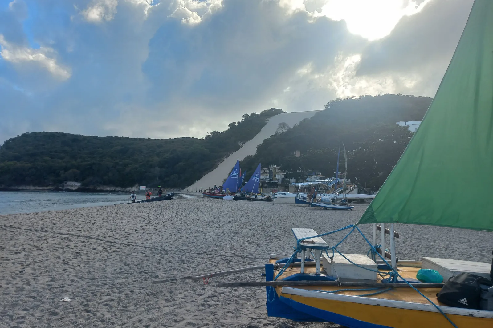
  • A wooden sailing boat with a green sail pulled up on the sand at Ponta Negra in the early morning, backlit, with Morro do Careca in haze behind it

    Free · Around 5:00am

    Sunrise on Ponta Negra beach

    Natal faces east, which means the sun comes up out of the ocean in front of the hotels rather than behind them. The beach is busy at that hour with runners, fishermen dragging boats up the sand and the kiosks setting out chairs, and the light on the face of Morro do Careca is the best it gets all day. Sunrise is between about 4:50am and 5:30am all year here, because you are only six degrees off the equator.

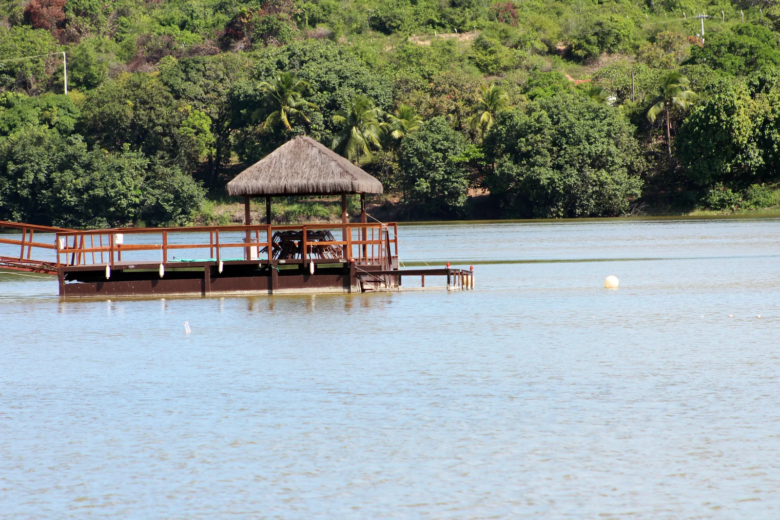
  • A thatched wooden deck built out over the still water of the Lagoa de Extremoz, with dense green forest along the far shore

    About 25 km north · Half day

    An afternoon on Lagoa de Extremoz

    The lagoon behind the dunes at Extremoz is where the city drinks from and where it goes on the weekend: flat brown-green water, forest to the edge, thatched decks built out over it and boats for hire by the hour. It is the calm half of a north-coast day.

City and History

  • A rusted cannon on a gray spoked-wheel carriage standing on the open upper deck of the Fortaleza dos Reis Magos, with a white sentry turret behind it and the towers of Natal across the water

    Tuesday to Sunday, 8:00am to 4:00pm · R$10

    Walking the ramparts at the Fortaleza dos Reis Magos

    An hour, and the best hour of history on this coast. You cross the causeway on foot, climb onto the terreplein among the cannon, and get the whole skyline of Natal laid out across the river mouth. Residents of Natal go free; everyone else pays R$10, a price the state set in February 2025. Closed Mondays, 25 December, 1 January and election days. Go early, because there is no shade up there and this is the sunniest coastal city in Brazil.

  • Red plastic tables and chairs under red and green umbrellas on the sand at Praia do Meio in Natal, with people walking at the water’s edge and dark rocks at the far end of the beach

    Free · Daytime

    A morning at Praia do Meio and Praia dos Artistas

    The old city beaches, below the Cidade Alta and within sight of the fort, are where Natal went to the sea before Ponta Negra existed. Rock groynes break the swell into a line of pools, kiosks put tables and umbrellas straight onto the sand, and the crowd is local rather than visiting. It is scruffier than Ponta Negra and it is a better window on the city. Daytime only.

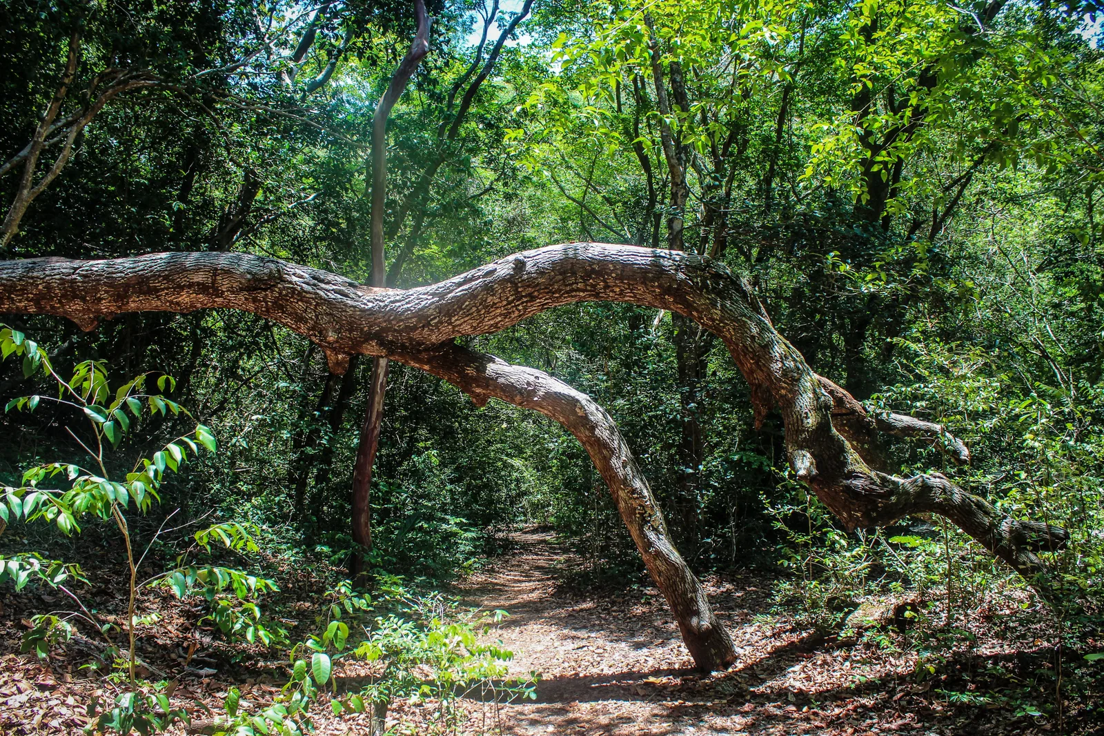
  • A shaded forest trail at the Parque das Dunas in Natal, with a long curved fallen branch crossing the frame and dense green undergrowth on both sides

    Guided trails · Closed Mondays

    Trails at the Parque das Dunas

    Between the Via Costeira hotels and the city there is a reserve of Atlantic forest growing on old fixed dunes, more than a thousand hectares of it inside the city limits. The trails are walked with a guide and the canopy is full of marmosets and birds. A good use of an overcast morning.

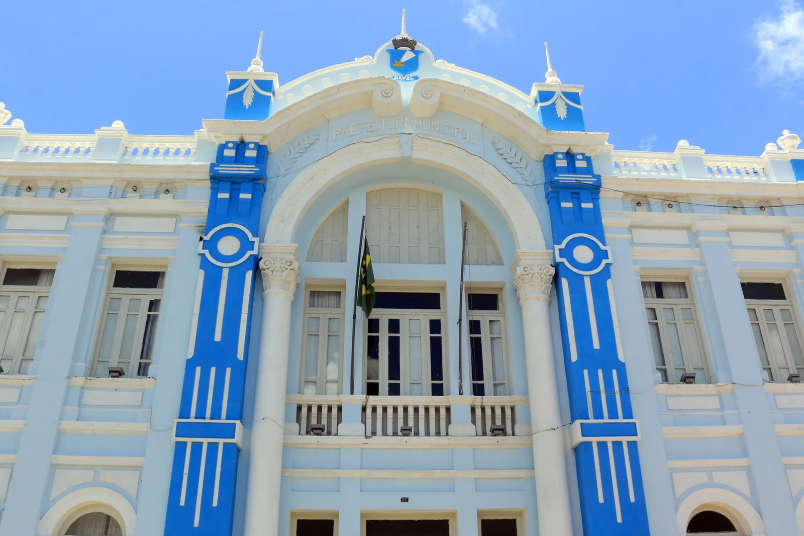
  • The facade of the Palácio Felipe Camarão in Natal: a civic building painted pale blue with bright blue pilasters, a tall arched central bay over a balcony and flag, shuttered windows and small pinnacles along the roofline

    Half a morning · Weekdays are livelier

    The old center at Cidade Alta

    Natal’s historic core is small and unpolished, and it is worth an hour on the way to or from the fort. The Palácio Felipe Camarão, the city hall, is a blue and white eclectic pile from the early twentieth century, and the streets around it still carry the shopfronts and churches of a small colonial river port that grew up fast in the twentieth century.

  • A wooden sailing boat with a green sail pulled up on the sand at Ponta Negra in the early morning, backlit, with Morro do Careca in haze behind it

    Free · Around 5:00am

    Sunrise on Ponta Negra beach

    Natal faces east, which means the sun comes up out of the ocean in front of the hotels rather than behind them. The beach is busy at that hour with runners, fishermen dragging boats up the sand and the kiosks setting out chairs, and the light on the face of Morro do Careca is the best it gets all day. Sunrise is between about 4:50am and 5:30am all year here, because you are only six degrees off the equator.

Day Trips

  • View forward from inside a yellow beach buggy with its roof up, following another buggy along a wide flat beach beside the surf

    Half day to full day · From Ponta Negra

    Buggy run at Genipabu

    The signature trip and the reason the buggy exists in Natal. A licensed driver takes up to four passengers north from the city over the Newton Navarro bridge and off the road onto the Genipabu dunes, then across the Ceará-Mirim river on a small raft ferry to the lagoons beyond. Drivers are accredited by SETUR, the state tourism department. Somewhere on the first ridge yours will ask whether you want the ride com emoção or sem emoção, with excitement or without. Answer honestly.

  • The beach at Maracajaú at low tide: a broad expanse of wet flat sand and shallow water with small boats moored far out toward the horizon

    Half day · Low tide only · About 55 km north

    Snorkeling the parrachos at Maracajaú

    Boats run 5 to 7 km offshore to the reef, and on a good low tide you swim over coral in water clear enough to read the bottom. The whole thing is tide-dependent, so the departure time is whatever the tide table says that day, and the reef is inside a state protected area with rules about touching and standing on it. The catamaran trip with mask and snorkel is the standard version; a guided dive with a tank is the upgrade.

  • A thatched wooden deck built out over the still water of the Lagoa de Extremoz, with dense green forest along the far shore

    About 25 km north · Half day

    An afternoon on Lagoa de Extremoz

    The lagoon behind the dunes at Extremoz is where the city drinks from and where it goes on the weekend: flat brown-green water, forest to the edge, thatched decks built out over it and boats for hire by the hour. It is the calm half of a north-coast day.

  • The Pirangi cashew tree seen from its raised viewing platform, a dense unbroken mass of green canopy filling the frame with the roofs of the surrounding village visible at its edge

    About 25 km south · Under an hour on site

    The cashew tree at Pirangi

    From the air the Pirangi cashew tree reads as a solid block of canopy with a village built around the edges of it, which is the only way to take in the scale. On the ground you walk a boardwalk through the inside of it. Combine it with the beaches at Pirangi and Cotovelo on the same run south and it makes an easy half day.

Food

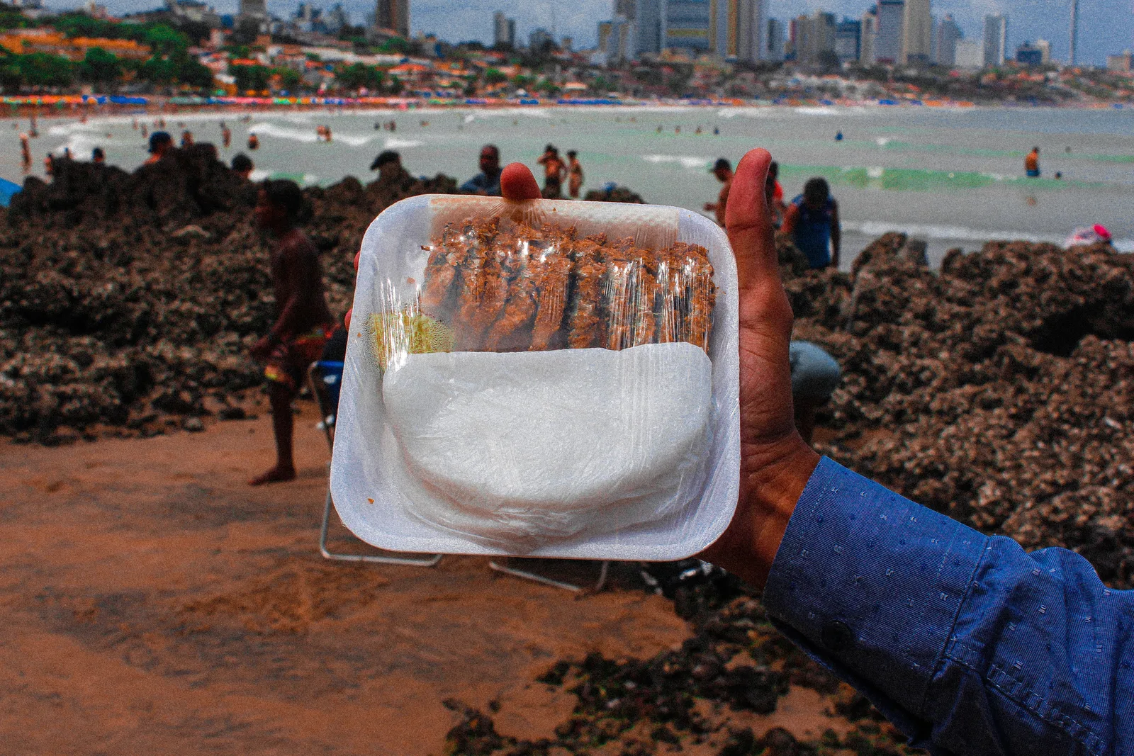
  • A hand holding a plastic-wrapped tray with a row of little fried fish above a folded white tapioca, on a beach of dark reef rock with bathers and the city skyline behind

    A few reais · Mornings at the market

    Ginga com tapioca at Redinha

    The dish Natal actually made. Ginga is a tiny estuary fish that used to be thrown back out of the fishermen’s drag nets at Redinha, on the north bank of the river. Somebody started rolling it, fried, into a folded tapioca, and it became the city’s own street food. Natal’s city council made both the dish and the 1921 Mercado da Redinha official cultural heritage, and the state did the same for the dish in 2019. Eat it standing up.

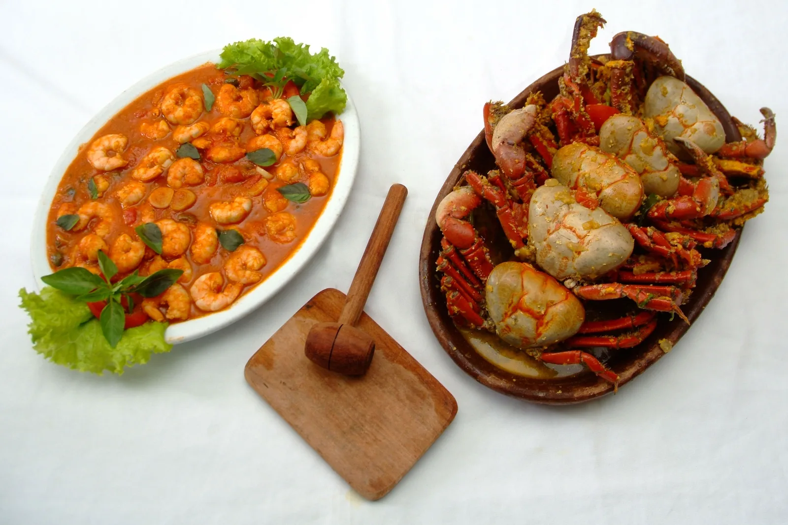
  • A white oval dish of shrimp in an orange sauce beside an oval clay dish of whole cooked crabs, with a small wooden mallet on a board between them

    Lunch · Ponta Negra and Redinha

    Shrimp and crab on the seafront

    Rio Grande do Norte is Brazil’s second-biggest shrimp producer, and it shows up on the plate rather than on the menu. Camarão comes grilled, in coconut sauce, in a pastel or piled on a board. Caranguejo, the mangrove crab, arrives whole with a wooden mallet and an apron, and it is a two-hour lunch rather than a meal.

Where to Stay

Four places to base yourself

Natal’s visitor beaches run in one long line from the fort in the north to Morro do Careca in the south, about 15 km of it, and where you sit on that line decides what your mornings look like. There is also a case for skipping the city and sleeping next to the dunes.

Drag and zoom to explore.

Tap an area to open it and see it on the map

  • Our pick

    Best for: First-time visitors, couples, anyone without a car

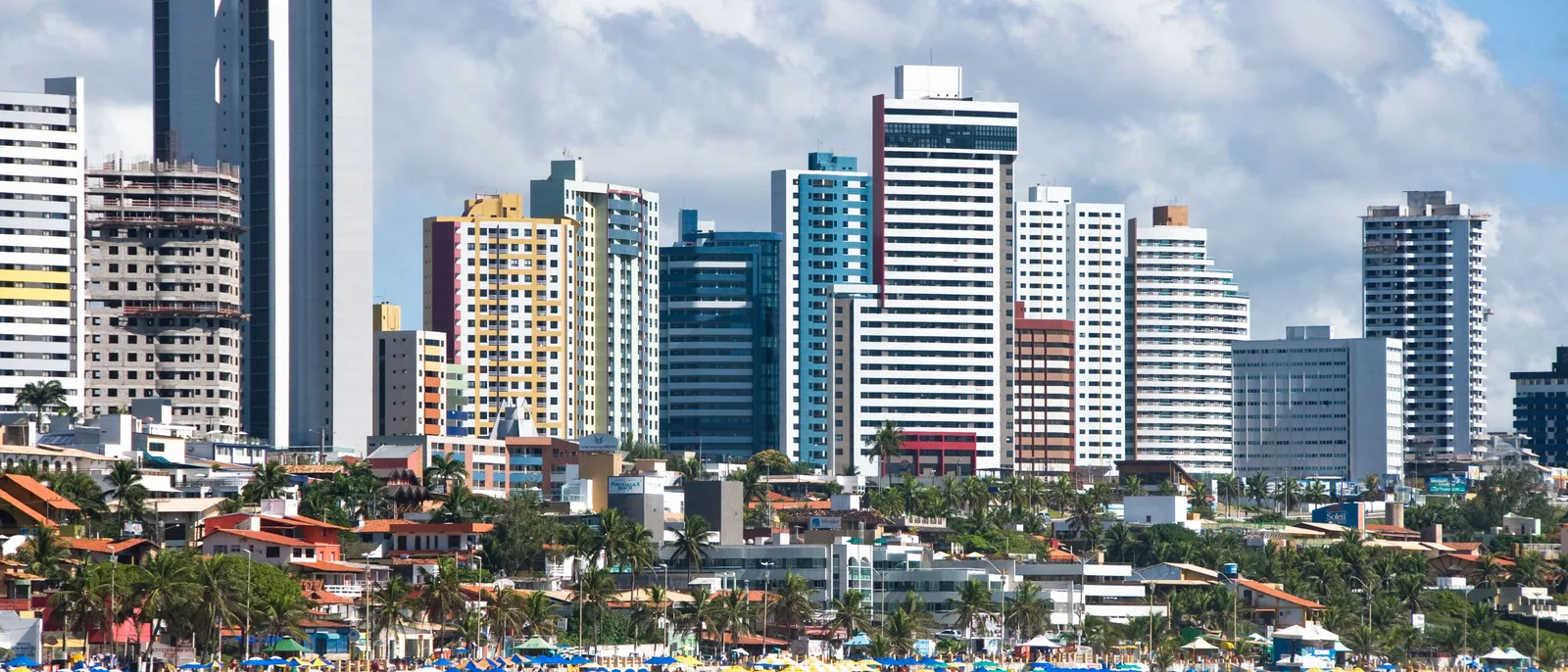
    A wall of apartment and hotel towers at Ponta Negra rising above the low red-tiled roofs and trees at their feet

    The default, and for most people the right answer. Ponta Negra is a compact beachfront neighborhood at the southern end of the city with the widest range of rooms in Natal, restaurants and bars you can walk to, kiosks on the sand and Morro do Careca at the end of the view. It is where the buggy operators pick up, it is lit and busy at night, and you can spend a week here without ever getting into a car except to leave.

    • Walkable
    • Widest choice
    • Nightlife
    • Busiest
  • Best for: Resorts, families who want a pool, quiet

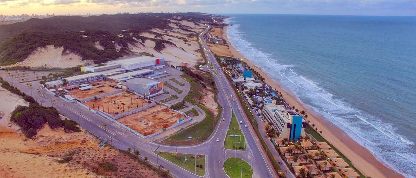
    Aerial view along the Via Costeira in Natal: a coast road with the open sea and its beach on one side and a bank of bare sand and dark scrub on the other, and low buildings and parking spread between them

    A ten-kilometer road with the Atlantic on one side and the Parque das Dunas forest on the other, and almost nothing on it but hotels. This is where Natal’s resorts sit, and the appeal is obvious: sea in front, protected forest behind, no traffic noise and no through streets. The catch is equally obvious. There is nothing within walking distance except your own hotel, so every meal out and every trip into town is a ride app. Good if you came for a pool and a beach; frustrating if you came to wander.

    • Resorts
    • Quiet
    • Need a car or app
    • Sea-facing
  • Best for: Budget travelers, short stays, anyone doing the fort and the center

    A rock sea wall in the foreground at Praia do Meio in Natal, with a strip of sand curving away past a few bathers and a dark ledge of reef lying offshore

    Praia do Meio, Praia dos Artistas and Areia Preta run north from the Via Costeira toward the fort, under the Farol de Mãe Luíza. This is old Natal by the sea: cheaper rooms, more local life, reef pools instead of open surf, and the historic center and the fort ten minutes away. It is the least polished of the three city options and it empties out after dark, so plan on going elsewhere for dinner. Worth it for a two-night stop or a tight budget.

    • Cheapest
    • Local
    • Near the fort
    • Quiet at night
  • Best for: A second base, dune mornings, escaping the city

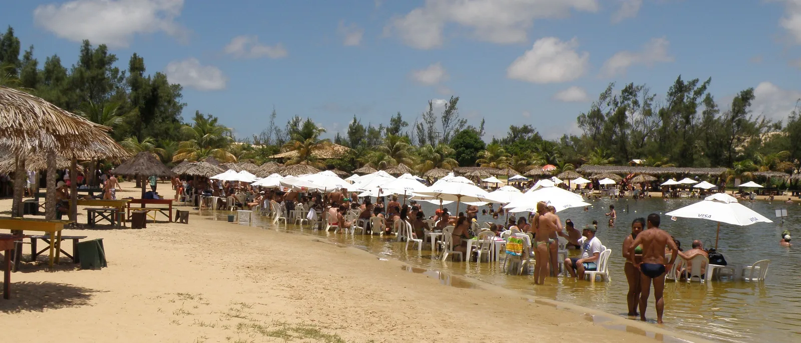
    White parasols and plastic tables set out in the shallow water of a lagoon in the Genipabu dune park, with thatched shelters on the sand and people standing in the water beside them

    Fifteen kilometers north of the center, in Extremoz, there are pousadas within sight of the dunes themselves. Waking up here means being on the sand before the day trips arrive from the city, which is the single best argument for it, and the beach barracas at Genipabu are a pleasant way to lose an afternoon. It only makes sense as a second base or for travelers who want two or three quiet days, because everything else in this guide is back down the road in Natal.

    • Next to the dunes
    • Small pousadas
    • Rural
    • Second base

Suggested Itinerary

Four days in and around Natal

Four days covers the city, the dunes and one reef properly, with the arrival and departure transfers built in. Three works if you drop the reef day. Anything longer and you are really using Natal as a base for the wider state.

  1. 01
    Rows of yellow and red beach umbrellas and tables on the sand at Ponta Negra, with the green and sand slope of Morro do Careca rising behind them

    Ponta Negra

    Land, and go straight to the beach

    Allow 45 minutes from the airport. Then do nothing complicated: walk the length of Ponta Negra to the foot of Morro do Careca, take a table at a kiosk, and eat shrimp while you work out what the wind is going to do to your week.

  2. 02
    A white beach buggy carrying passengers driving along the wet sand at the edge of the surf, with a low hazy shoreline in the distance

    Extremoz and the dune field

    The buggy day on the north coast

    The full-day version: north over the bridge onto the Genipabu dunes, across the river by ferry to the lagoons at Pitangui and Jacumã, lunch on the water and back down the beach in the afternoon. Book an accredited driver and start early.

  3. 03
    A wide bright view along the beach at Maracajaú with blue water, small boats offshore and green scrub in the foreground

    Maxaranguape, 55 km north

    Out to the reef

    A tide-dependent half day: an hour up the coast, half an hour out to the parrachos by catamaran, then an hour and a half in the water over the coral. Whatever the tide leaves you in the afternoon, spend it on the beach at Maracajaú.

  4. 04
    The Fortaleza dos Reis Magos seen across a vast expanse of bare wet sand exposed by a low tide, its white walls low against a cloudy sky

    Cidade Alta, Redinha and Pirangi

    The fort, the old center and the tree

    Fort first thing before the sun gets on top of it, then the Cidade Alta, then ginga com tapioca at Redinha across the bridge. If your flight is late, the cashew tree at Pirangi is fifteen minutes south of Ponta Negra, but it is in the opposite direction from the airport, so go in the morning, not on the way to your flight.

This is a starting shape, not a fixed departure — we rearrange it around your dates. Have it built for you

When to Go

The driest, sunniest half of the year is the second half

Nothing here is ruled out by temperature. Highs sit between 28 and 31 degrees every month of the year and the sea never drops below about 27, so the only variables that matter are rain, sun and wind. Rain is heavily concentrated in March to July, and October is both the driest month and the sunniest.

Twelve months of average air and sea temperature, rainfall, rainy days and UV index for Natal. Use the arrow keys to move between months.

January

Good
Air
24–30°C 75–86°F
Sea
28°C 82°F
UV
11 Extreme
Rain
7 days 81 mm / 3.2 in

Hot and bright, in the middle of the Brazilian summer holidays.

February

Good
Air
25–31°C 77–88°F
Sea
28°C 82°F
UV
12 Extreme
Rain
8 days 100 mm / 3.9 in

Still in the dry half of the year and still hot. The last easy month before the rains arrive.

March

Trade-offs
Air
24–31°C 75–88°F
Sea
29°C 84°F
UV
11 Extreme
Rain
13 days 201 mm / 7.9 in

The rains start and the summer crowd goes. Days are still 31 degrees and the sea is at its warmest.

April

Trade-offs
Air
24–30°C 75–86°F
Sea
29°C 84°F
UV
11 Extreme
Rain
16 days 241 mm / 9.5 in

Wet season proper, and the lightest wind of the year at 3.5 m/s.

May

Trade-offs
Air
23–30°C 73–86°F
Sea
28°C 82°F
UV
9 Very high
Rain
15 days 222 mm / 8.7 in

Still wet and still warm.

June

Trade-offs
Air
22–29°C 72–84°F
Sea
28°C 82°F
UV
8 Very high
Rain
18 days 349 mm / 13.7 in

The wettest month of the year and the least sunny at 199 hours. Festa Junina fills the whole Northeast with bonfires and forró.

July

Trade-offs
Air
21–28°C 70–82°F
Sea
27°C 81°F
UV
8 Very high
Rain
16 days 254 mm / 10.0 in

Still wet, and it is the Brazilian winter school break.

August

Good
Air
21–29°C 70–84°F
Sea
27°C 81°F
UV
10 Very high
Rain
12 days 119 mm / 4.7 in

The hinge. Rain halves from July and the sun climbs back to 254 hours, but it still falls on twelve days and the wind is building.

September

Good
Air
22–29°C 72–84°F
Sea
27°C 81°F
UV
11 Extreme
Rain
8 days 54 mm / 2.1 in

The dry season resumes: 267 hours of sun and rain on eight days. Also the windiest month of the year at 5.1 m/s.

October

Best
Air
24–30°C 75–86°F
Sea
27°C 81°F
UV
11 Extreme
Rain
5 days 21 mm / 0.8 in

The peak, and it is not close. The driest month at 20.6 mm and the sunniest at 295 hours. Hot, bright and still windy.

November

Good
Air
24–30°C 75–86°F
Sea
27°C 81°F
UV
11 Extreme
Rain
4 days 23 mm / 0.9 in

The fewest rainy days of any month, four, with 286 hours of sun.

December

Good
Air
25–30°C 77–86°F
Sea
27°C 81°F
UV
11 Extreme
Rain
5 days 29 mm / 1.1 in

Dry and hot. Carnatal fills the city on the first weekend, then it is quiet until about the twentieth, when the Christmas and summer holidays begin.

  • Best The one or two peak months
  • Good A real recommendation
  • Trade-offs Workable, with a catch
See Natal on the Brazil calendar

UV is the monthly average of the daily peak, 2022 to 2025, calculated from Copernicus Atmosphere Monitoring Service data. Weather data by Open-Meteo.com, CC BY 4.0.

Best month

October

The driest month of the year at 20.6 mm on five rainy days, and the sunniest at 295 hours. Nothing else wins both.

Also dry

September to December

Every month from September to December gets under 55 mm of rain on eight or fewer rainy days, and November has the fewest rainy days of the year, four.

The wet season

March to July

June is the wettest month by a wide margin, 349 mm on eighteen rainy days, and the least sunny. Warm throughout, but the sun goes.

The catch

Wind, August to November

The trade blows hardest in exactly the months you want to come: 5.1 m/s in September, 5.0 in October, against 3.5 in April.

About the rain

The shape of the year is the useful thing, and it is stark. On INMET’s 1991-2020 normals for the Natal station, the five months from March to July carry 1,266 mm of the annual 1,691 mm, three quarters of the year’s rain. Then it stops: 119 mm in August, 54 in September, and three consecutive months of 21 to 29 mm to close the year. October gets rain on five days and November on four. INMET’s two normals periods, 1981-2010 and 1991-2020, agree on both ends of that, and both name October the driest month and June the wettest.

The wind is the thing to plan around, and no other page on this coast has to say it as loudly. INMET’s wind normals give Natal an annual mean of 4.2 meters a second, against 2.9 at Fortaleza, 2.4 at Recife and 1.6 at Salvador, and the strongest months are August through November at 4.6 to 5.1. That is a steady fresh breeze on an open beach in exactly the months with the best weather. It is why the dunes exist and why the state runs on wind power, and it also means an umbrella needs burying, a hat needs a strap, and the sheltered corners of the beach fill up first. If a still, glassy sea matters more to you than sunshine, April is the calm month, and it is also the wettest half of the year.

One note on the UV column: six degrees off the equator, with almost 3,000 hours of sun a year, the index sits in the top bands in every month. This is not a place to test your sunscreen.

The dates worth planning around

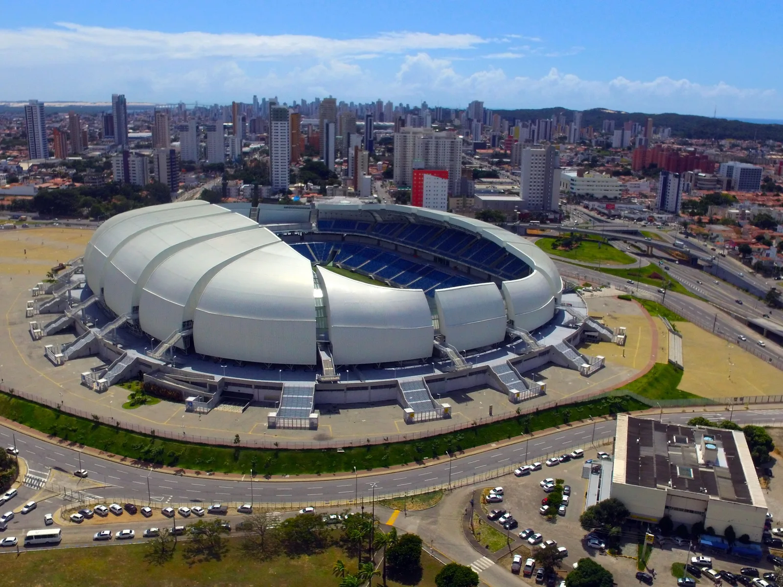
Aerial view of the Arena das Dunas stadium in Natal, a white segmented roof structure surrounded by parking lots and the city’s apartment blocks

Carnatal

First weekend of December

An out-of-season carnival built around electric trios circling the Arena das Dunas. The 2026 edition is scheduled for 4 to 6 December.

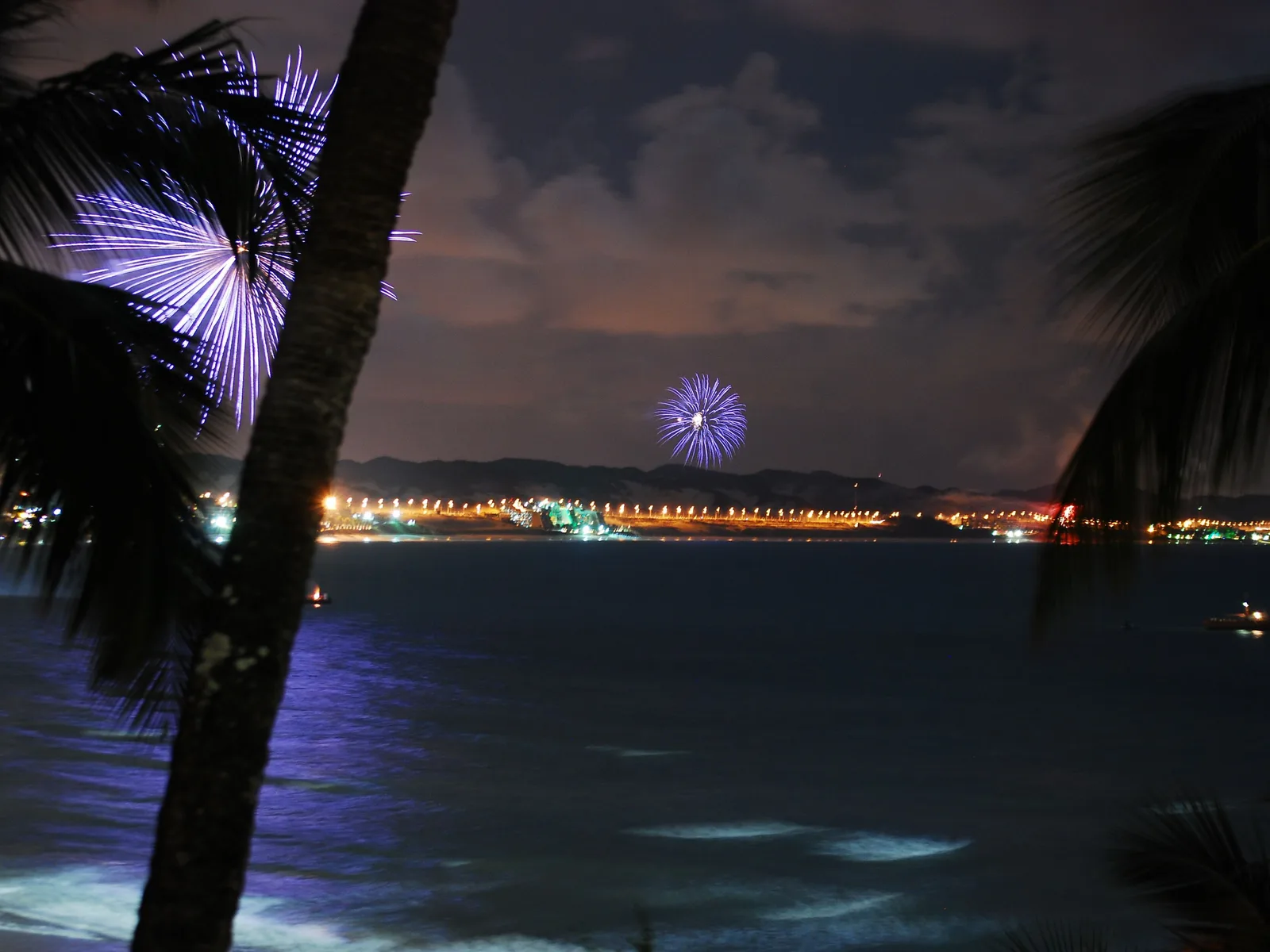
New Year fireworks bursting over a long lit shoreline across dark water at Ponta Negra, seen past a palm trunk and fronds

Réveillon at Ponta Negra

31 December

The whole city moves onto the beach in white for New Year, and the fireworks go up off the sand in front of Morro do Careca. It is free, and it is enormous.

Questions

Natal, answered

Why Natal rather than Fortaleza, Recife or Maceió? +

Two reasons you can check. Sunshine: INMET’s 1991-2020 normals give Natal 2,979.8 hours a year, more than any other coastal station in the country, against 2,845.9 at Fortaleza, 2,502.3 at Recife and 2,372.8 at Salvador. And the dunes: a live, moving sand field starts 25 km from the airport. If you want colonial architecture, go to Recife and Olinda instead. Natal is a landscape city.

How long do I need? +

Three days covers the city and the dunes. Four lets you add a reef day at Maracajaú without rushing the tide. More than four and you are really using Natal as a base for the wider coast, which is a perfectly good plan but a different one. If Pipa is on the same trip, two nights here covers Ponta Negra and the buggy day; Maracajaú and the fort are the first things to drop.

How far is Pipa from Natal? +

About 85 km south by road, an hour and a half on the BR-101, and it has its own guide on this site.

Do I need to rent a car? +

Probably not. The dune trips are all done by buggy with an accredited driver, the reef trips include transport, and ride apps between the beach districts cost a few dollars. Rent a car only if you intend to drive the state yourself, in which case take it from the airport rather than from town.

When is the best time to go? +

October, on the numbers: it is both the driest month of the year and the sunniest. September through December is all good, and November has the fewest rainy days of any month. Avoid March to July if the beach is the point, because June alone brings 349 mm of rain across eighteen days. The one caveat is wind, which is strongest from August to November, straight through the best weather.

Free · 29 pages

Free guide

Beginner's Guide to Brazil

A free 29-page guide to everything a first-time visitor should know before landing: visas, safety, money, getting around, where to go, and what to eat.

We'll email you a link to confirm your address. Click it and the guide opens right away.

See what's inside
The cable-stayed Newton Navarro bridge crossing the wide green mouth of the Potengi river in Natal, with its concrete piers standing in the water and the far bank beyond

Plan It Properly

We plan trips to this coast

Natal is easy to enjoy and easy to get wrong. The buggy day, the reef day and the fort all depend on things a booking site will not tell you: which driver is accredited, what the tide is doing, and which month the wind will be leaning on your umbrella. We build the whole route by hand, in the order that works.

  • A day-by-day plan built around the tide table, not around a template
  • Accredited buggy drivers and reef operators, booked before you land
  • Rooms in the neighborhood that fits how you actually want to spend your mornings
  • The rest of the northeast coast joined up around it, if you want more than Natal